
| Area | Southern Mattole |
| Topic | Temperature: Min, Max and Avg, Mattole RM 56.7 (dstrm), 2001 |
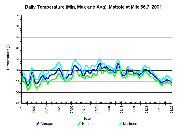
| Caption: Average, minimum, and maximum water temperatures for the Mattole River at river mile 56.7, immediately downstream from the "Gibson Hole" just below the water surface. The thermograph was placed by the Mattole Salmon Group from approximately May 23 through September 20, 2001, using Forest Science Project protocols. | |
 |
To learn more about this topic click Info Links .
To view a table of information about this data click Metadata .
To view the table with the chart's data, click Chart Table web page.
To download the table with the chart's data, click 86488matt_56.7_dstrm_mma.db (size 8,192 bytes) .
To view the table with the chart's source data, click Source Table web page.
To download the table with the chart's source data, click mattemp_south_msg_2001.dbf (size 382,297 bytes)
| www.krisweb.com |