
| Area | Southern Mattole |
| Topic | Temperature: Min, Max and Avg, Mattole RM 56.7, 2001 |
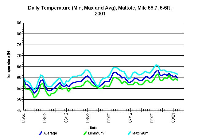
| Caption: Average, minimum, and maximum water temperatures for the Mattole River at river mile 56.7 at the "Gibson Hole" at a water depth between 5.5-6 feet. The thermograph was placed by the Mattole Salmon Group from approximately May 23 through October 5, 2001, using Forest Science Project protocols. | |
 |
To learn more about this topic click Info Links .
To view a table of information about this data click Metadata .
To view the table with the chart's data, click Chart Table web page.
To download the table with the chart's data, click 86466matt_56.7_mma.db (size 6,144 bytes) .
To view the table with the chart's source data, click Source Table web page.
To download the table with the chart's source data, click mattemp_south_msg_2001.dbf (size 382,297 bytes)
| www.krisweb.com |