
| Area | Southern Mattole |
| Topic | Temperature: Min, Max and Avg, Yew Creek, 2001 |
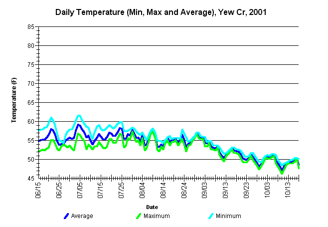
| Caption: Minimum, maximum, and average daily water temperatures for Yew Creek, from mid-June through Mid-October, 2001. The thermograph was located approximately 50 feet upstream from the confluence of Yew Creek with Thompson Creek. See the Chart Table Caption for site (stream) identifiers. | |
 |
To learn more about this topic click Info Links .
To view a table of information about this data click Metadata .
To view the table with the chart's data, click Chart Table web page.
To download the table with the chart's data, click mattemp01_yew_mma.db (size 8,192 bytes) .
To view the table with the chart's source data, click Source Table web page.
To download the table with the chart's source data, click mattemp01_yew_mma.db (size 8,192 bytes)
| www.krisweb.com |