| Area |
Southern Mattole |
| Topic |
USFS VegTypes - Calwater Area: Thompson Creek 1994 |
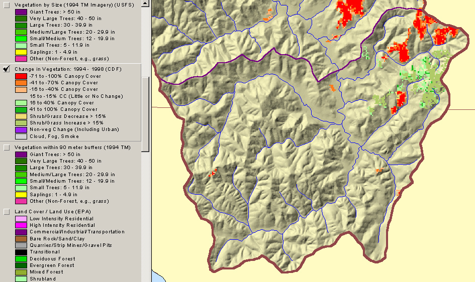
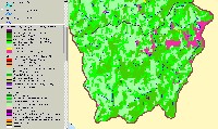 Click on image to enlarge (67K). Click here to display a larger version (445K).
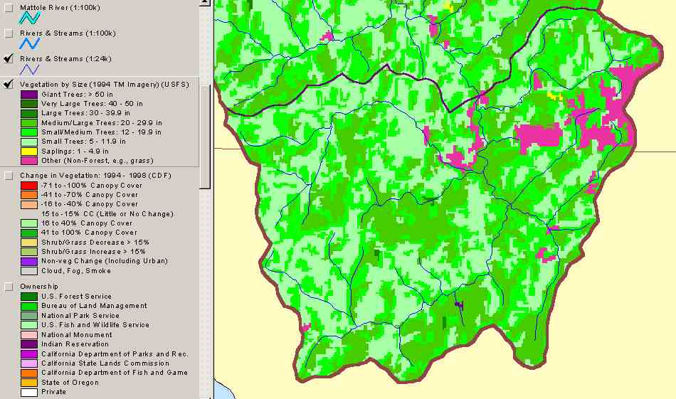
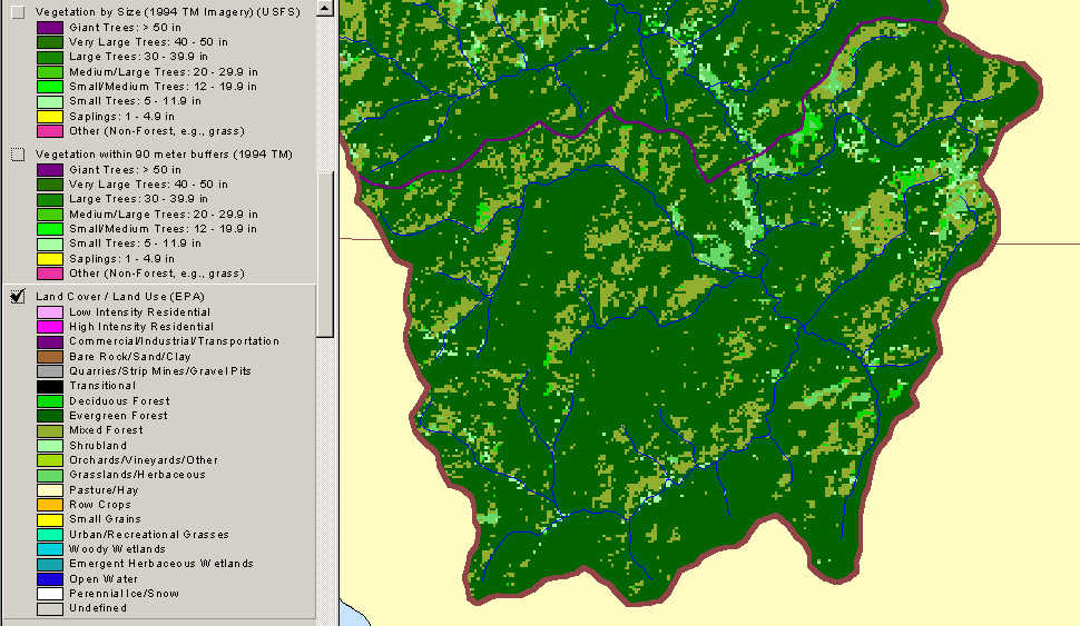
The image above shows USFS tree size classes for the Thompson Creek Calwater in the Mattole Basin based on a 1994 Landsat image. The stand types are only accurate at the one-hectare scale. Legend from ArcView appears at left. See Info Links for more information. This image is taken from the KRIS Mattole Map project.
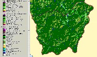 Click on image to enlarge (65K). Click here to display a larger version (404K).
The image above shows Land Cover types by the EPA for the Thompson Creek Calwater in the Mattole Basin based on a 1994 Landsat image. Legend from ArcView appears at left. See Info Links for more information. This image is taken from the KRIS Mattole Map project.
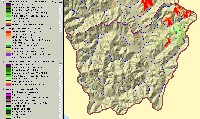 Click on image to enlarge (68K). Click here to display a larger version (383K).
The image above shows change scene detection by CDF for the Thompson Creek Calwater in the Mattole Basin based on a 1994 Landsat image. Legend from ArcView appears at left. See Info Links for more information. This image is taken from the KRIS Mattole Map project.
To learn more about this topic click Info Links

 Click on image to enlarge (67K). Click here to display a larger version (445K).
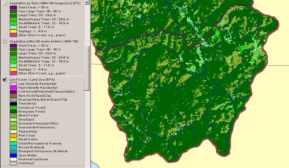 Click on image to enlarge (65K). Click here to display a larger version (404K).
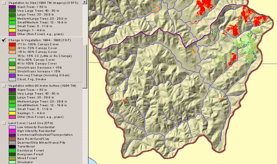 Click on image to enlarge (68K). Click here to display a larger version (383K).
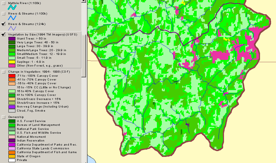