
| Area | Southern Mattole |
| Topic | Temperature: MWATs in Southern Tributaries (Fahrenheit) |
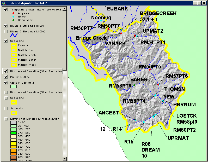
This image from the KRIS Mattole Map Project in Arcview shows the location of temperature monitoring sites in the Southern Mattole Sub-basin which is highlighted with a topographic backdrop. Sites where maximum floating weekly temperature exceeded 16.8 degrees C in all recorded years appear as red dots. Site labels come from the ORIG_ID column of the chart table and correspond to stream names and data originator as follows (press F7 for best view):
ORIG_ID STRMNAME CONTRIB
RM57PT6 Baker Creek FSP
BRIDGECREEK Bridge Creek FSP
R06 Dream Stream FSP
RM50PT7 Mattole River FSP
RM56PT5 Mattole River FSP
RM60PT2 Mattole River FSP
R15 Mattole River, Headwaters FSP
RM58PT6 Thompson Creek FSP
RM54_PT1 Van Auken Creek FSP
RM58PT4 Yew Creek FSP
52.1 + 1 Bridge Creek Mattole Salmon Group
RM58pt0 Lost River Creek Mattole Salmon Group
ANCEST Ancestor Creek NCRWQCB
BAKER Baker Creek NCRWQCB
Bridge Creek Bridge Creek NCRWQCB
DREAM Dream Stream NCRWQCB
HBRNUM Helen Barnum Creek NCRWQCB
LOSTCK Lost River Creek NCRWQCB
UPMAT2 Mattole River NCRWQCB
UPRMAT Mattole River NCRWQCB
THOMSN Thompson Creek NCRWQCB
VANARK Van Auken Creek NCRWQCB
YEW Yew Creek NCRWQCB
12 : R14 Mattole River Redwood Sciences Laboratory
 Click on image to enlarge (107K).
To learn more about this topic click Info Links
| www.krisweb.com |