
| Area | Western Mattole |
| Topic | Temperature: Peak Maximas in Western Tributaries (Fahrenheit) |
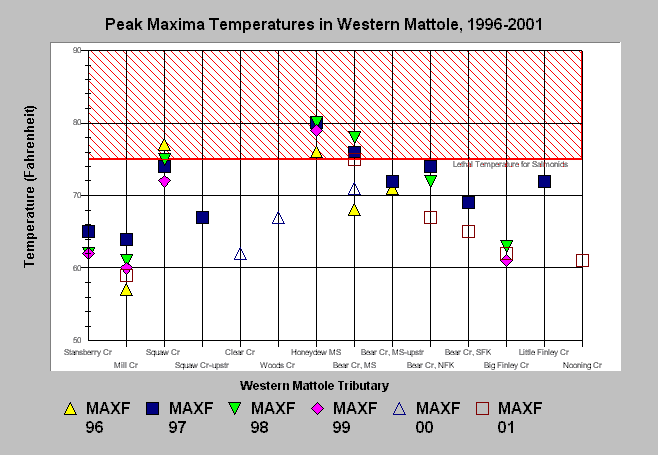
| Caption: This chart plots the maximum recorded water temperatures for each measured site in the Western Mattole by year. Sites measured in multiple years indicate that 2001 was a cooler year than 1997. Data was provided by the NCRWQCB. See Info Links for more information. | |
 |
To learn more about this topic click Info Links .
To view a table of information about this data click Metadata .
To view the table with the chart's data, click Chart Table web page.
To download the table with the chart's data, click temppkmax_west.dbf (size 2,178 bytes) .
| www.krisweb.com |