
| Area | Western Mattole |
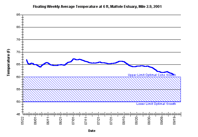
| Topic | Temperature: Floating Weekly Average, Mattole at RM 2.9 (6'), 2001 |
| Caption: The floating weekly average water temperature from May 21 through September 16, 2001, for the mainstem Mattole River at the at river mile 2.9. The thermograph was placed by the Mattole Salmon Group at a water depth between 5.5 feet and 6 feet, from approximately May 22 through September 21, using Forest Science Project protocols. | |
 |
To learn more about this topic click Info Links .
To view a table of information about this data click Metadata .
To view the table with the chart's data, click Chart Table web page.
To download the table with the chart's data, click 81779_matt_deep_2.9_avgfl.db (size 6,144 bytes) .
To view the table with the chart's source data, click Source Table web page.
To download the table with the chart's source data, click west_msg_2001.dbf (size 1,948,303 bytes)
| www.krisweb.com |