
| Area | Western Mattole |
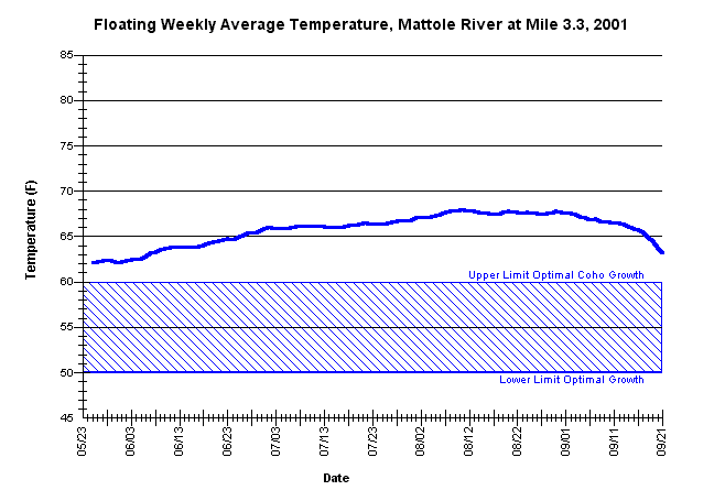
| Topic | Temperature: Floating Weekly Average, Mattole at RM 3.3, 2001 |
| Caption: Floating weekly average summer temperatures for the mainstem Mattole River at river mile 3.3. The thermograph was placed by the Mattole Salmon Group near a cold-water seep downstream from Titus Creek on the left bank of the mainstem, from approximately May 21 through September 21, using Forest Science Project protocols. | |
 |
To learn more about this topic click Info Links .
To view a table of information about this data click Metadata .
To view the table with the chart's data, click Chart Table web page.
To download the table with the chart's data, click 86453matt_3.3_avgfl.db (size 6,144 bytes) .
To view the table with the chart's source data, click Source Table web page.
To download the table with the chart's source data, click west_msg_2001.dbf (size 1,948,303 bytes)
| www.krisweb.com |