
| Area | Western Mattole |
| Topic | Temperature: Floating Weekly Average, Mattole at RM 3.5, 2001 |
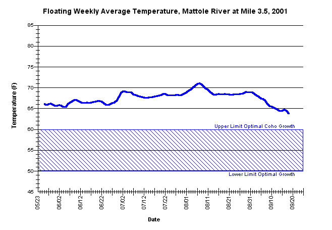
| Caption: Floating weekly average summer temperatures for the mainstem Mattole River at river mile 3.5. The thermograph was placed by the Mattole Salmon Group, from approximately May 21 through September 21, using Forest Science Project protocols. Notes by the MSG state that the thermograph "missed cold area through summer," however, the data is still valuable as an indicator of surface water temperature conditions. | |
 |
To learn more about this topic click Info Links .
To view a table of information about this data click Metadata .
To view the table with the chart's data, click Chart Table web page.
To download the table with the chart's data, click 86447matt_3.5_avgfl.db (size 6,144 bytes) .
To view the table with the chart's source data, click Source Table web page.
To download the table with the chart's source data, click west_msg_2001.dbf (size 1,948,303 bytes)
| www.krisweb.com |