
| Area | Western Mattole |
| Topic | Temperature: Floating Weekly Average, Mattole at RM 47.4, 2001 |
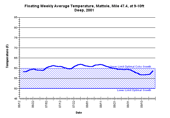
| Caption: Floating weekly average summer temperatures for the mainstem Mattole River at river mile 47.4, downstream at the" Big Finley Hole." The thermograph was placed by the Mattole Salmon Group from approximately June 12 through September 18, using Forest Science Project protocols. Temperature data appears to stabilize at a single reading for up to 6-8 hours at a time (see chart table) and may reflect constant pool temperature stratification and/or a logger recording inconsistency. | |
 |
To learn more about this topic click Info Links .
To view a table of information about this data click Metadata .
To view the table with the chart's data, click Chart Table web page.
To download the table with the chart's data, click 86451matt_47.4_avgfl.db (size 6,144 bytes) .
To view the table with the chart's source data, click Source Table web page.
To download the table with the chart's source data, click 86451matt_47.4.dbf (size 147,442 bytes)
| www.krisweb.com |