
| Area | Western Mattole |
| Topic | Temperature: Floating Weekly Average, Sholes Creek, Late Summer 2001 |
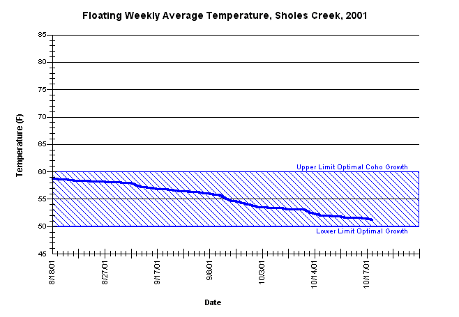
| Caption: The floating weekly average water temperatures for Sholes Creek, approximately 1000 upstream from its confluence with the Mattole River, from mid-August through mid-October, 2001. Date of thermograph placement did not capture the seasonal maximum temperatures and is included for informational purposes only. See the Chart Table Caption for site (stream) identifiers. | |
 |
To learn more about this topic click Info Links .
To view a table of information about this data click Metadata .
To view the table with the chart's data, click Chart Table web page.
To download the table with the chart's data, click sholes_avgfl.db (size 4,096 bytes) .
To view the table with the chart's source data, click Source Table web page.
To download the table with the chart's source data, click sholes.dbf (size 82,366 bytes)
| www.krisweb.com |