
| Area | Western Mattole |
| Topic | Temperature: Min, Max, Avg at Bear Creek (dstrm), 2001 |
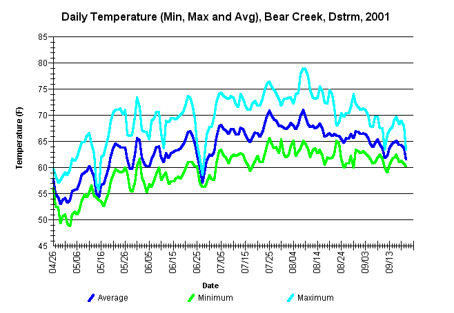
| Caption: Average, minimum, and maximum summer water temperatures for Bear Creek, approximately 0.5 miles upstream from its confluence with the Mattole River. The thermograph was placed by the Mattole Salmon Group from approximately April 26 through September 20, 2001, using Forest Science Project protocols. | |
 |
To learn more about this topic click Info Links .
To view a table of information about this data click Metadata .
To view the table with the chart's data, click Chart Table web page.
To download the table with the chart's data, click 873bear_dstrm_mma.db (size 8,192 bytes) .
To view the table with the chart's source data, click Source Table web page.
To download the table with the chart's source data, click west_msg_2001.dbf (size 1,948,303 bytes)
| www.krisweb.com |