
| Area | Western Mattole |
| Topic | Temperature: Min, Max, Avg, Mattole at River Mile 2.9 (6' deep), 2001 |
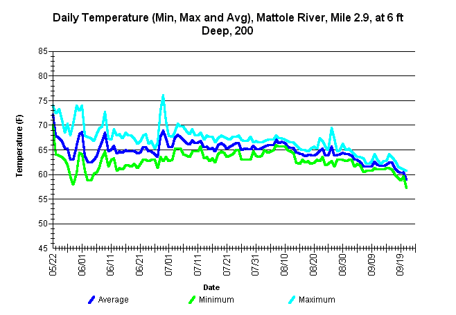
| Caption: Average, minimum, and maximum water temperatures for the mainstem Mattole River at river mile 2.9. The thermograph was placed by the Mattole Salmon Group at a water depth between 5.5 feet and 6 feet, from approximately May 22 through September 21, using Forest Science Project protocols. | |
 |
To learn more about this topic click Info Links .
To view a table of information about this data click Metadata .
To view the table with the chart's data, click Chart Table web page.
To download the table with the chart's data, click 81779matt_2.9_6ft_mma.db (size 8,192 bytes) .
To view the table with the chart's source data, click Source Table web page.
To download the table with the chart's source data, click west_msg_2001.dbf (size 1,948,303 bytes)
| www.krisweb.com |