
| Area | Western Mattole |
| Topic | Sediment: V* From the North Fork Bear Creek, 1992 & 1993 |
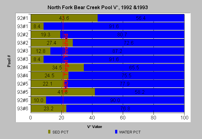
| Caption: This chart displays V* data from the North Fork Bear Creek measured in 1992 and 1993. The first pool # on the Y-axis is from 1992, the second from 1993. The 21% target threshold is from TMDLs for other North Coast Rivers and is barely exceeded by the 1992 and 1993 average of 24%. Values are from Knopp (1993). A V* of 50% indicates that half of the pool is filled with fine sediment. Data provided by the North Coast Regional Water Quality Control Board. See Info Links for more information. | |
 |
To learn more about this topic click Info Links .
To view a table of information about this data click Metadata .
To view the table with the chart's data, click Chart Table web page.
To download the table with the chart's data, click bear_vstar.dbf (size 1,778 bytes) .
To view the table with the chart's source data, click Source Table web page.
To download the table with the chart's source data, click knopp.dbf (size 12,582 bytes)
| www.krisweb.com |