| Area |
Western Mattole |
| Topic |
USFS VegTypes - Calwater Area: Big Finley Creek 1994 |
 Click on image to enlarge (82K). Click here to display a larger version (587K).
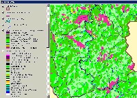
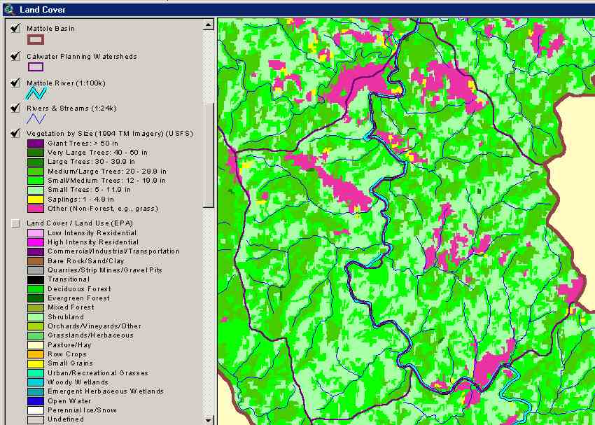
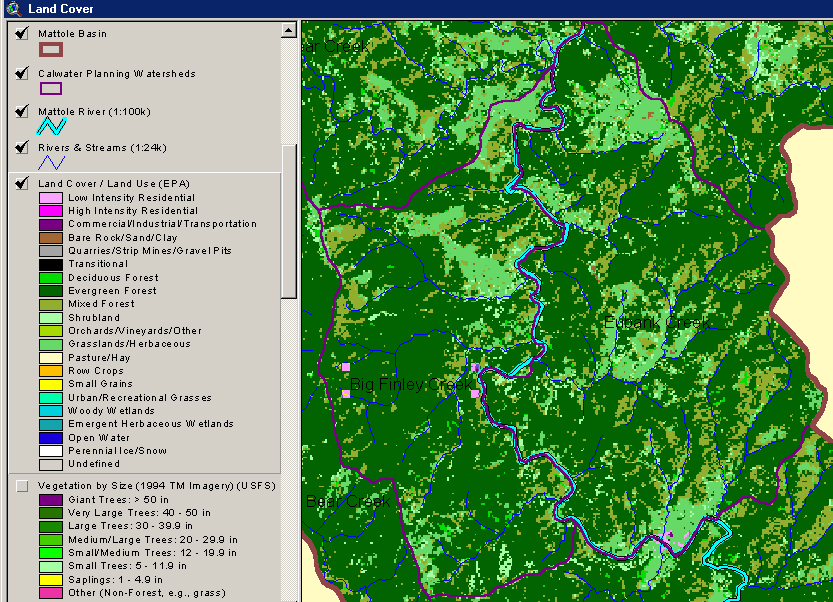
The image above shows tree size classes for the Big Finley and Eubank Creek planning watersheds of the Mattole Basin. Data is based on a 1994 Landsat imagery. The classification is appropriate for characterizing stands and only accurate at the one-hectare scale. Legend from ArcView appears at left. This image is taken from the KRIS Mattole Map project.
 Click on image to enlarge (75K). Click here to display a larger version (398K).
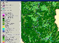
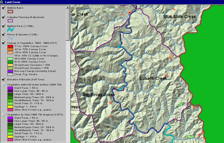
The image above shows change in vegetation between 1994 and 1998 in select planning watersheds of the Mattole Basin. Data was provided by the California Department of Forestry. Legend from ArcView appears at left. This image is taken from the KRIS Mattole Map project.
 Click on image to enlarge (82K). Click here to display a larger version (534K).
To learn more about this topic click Info Links

 Click on image to enlarge (82K). Click here to display a larger version (587K).
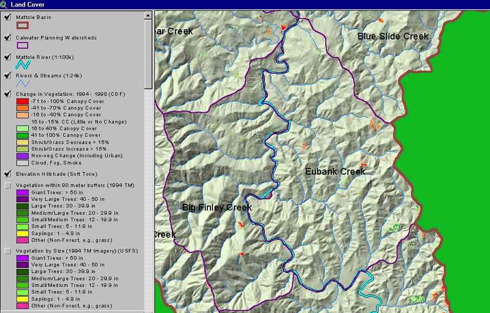 Click on image to enlarge (75K). Click here to display a larger version (398K).
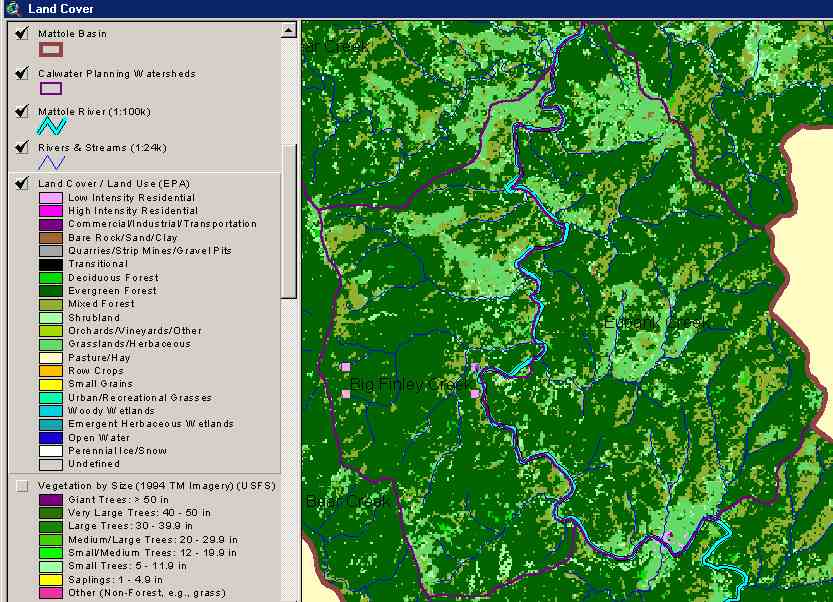 Click on image to enlarge (82K). Click here to display a larger version (534K).
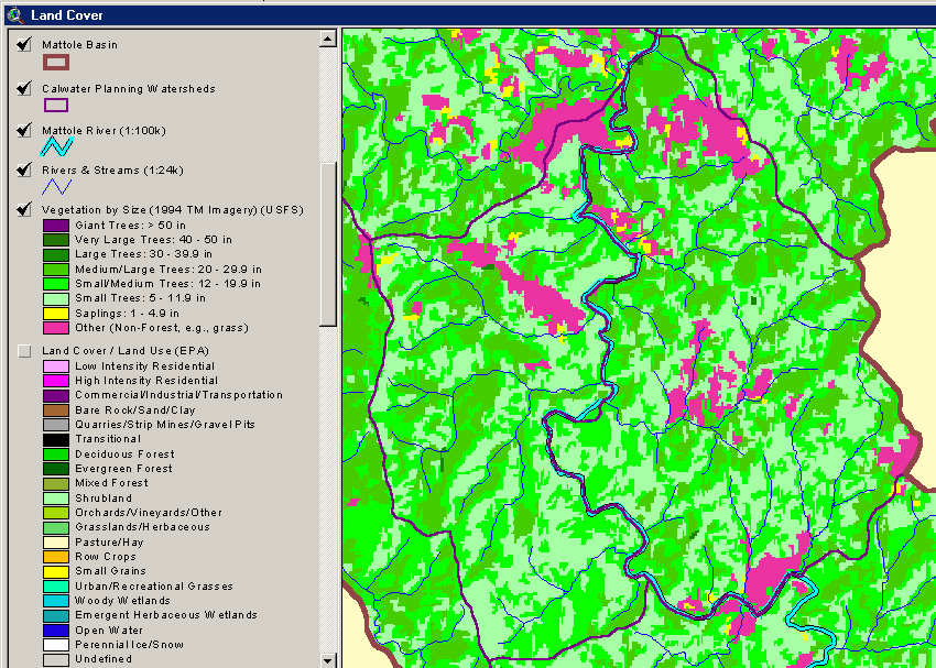