| Area |
Anderson Creek |
| Topic |
Tour: Soda Creek Upland Grazing Photo June 2002 |
 Click on image to enlarge (49K). Click here to display a larger version (157K).
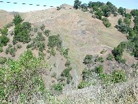
This photo shows an earth flow with active surface erosion above Soda Creek, which is out of view down in the canyon. The hummocky nature of the terrain and the patches of green indicate water just under the surface because of sheared, impermeable soil masses below. The impermeable layer may also form failure planes for landslides (see Picture #2). Photo by Pat Higgins, June 12, 2002.
 Click on image to enlarge (45K). Click here to display a larger version (248K).
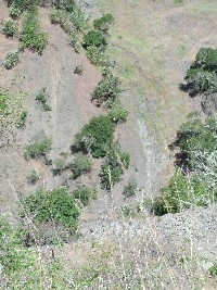
This photo shows active surface erosion at the toe of the earth flow from the previous picture which is being deposited directly into Soda Creek. The trails in the hillslope at upper right indicate that soil loss at this site may have been exacerbated by grazing. The rip rap in the lower right of the photo is armoring for the hillslope which supports Highway 253. If this rock extends into the stream, it may have constricted the creek and deflected its flow into the toe of the earth flow, re-activating it. Photo by Pat Higgins, June 12, 2002.
 Click on image to enlarge (127K).
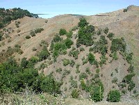
The hillside in the center of the photo shows signs of intensive grazing with stock trails criss-crossing the steep inner gorge area (close up in Picture #4). Photo by Pat Higgins, June 12, 2002.
 Click on image to enlarge (137K).
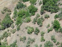
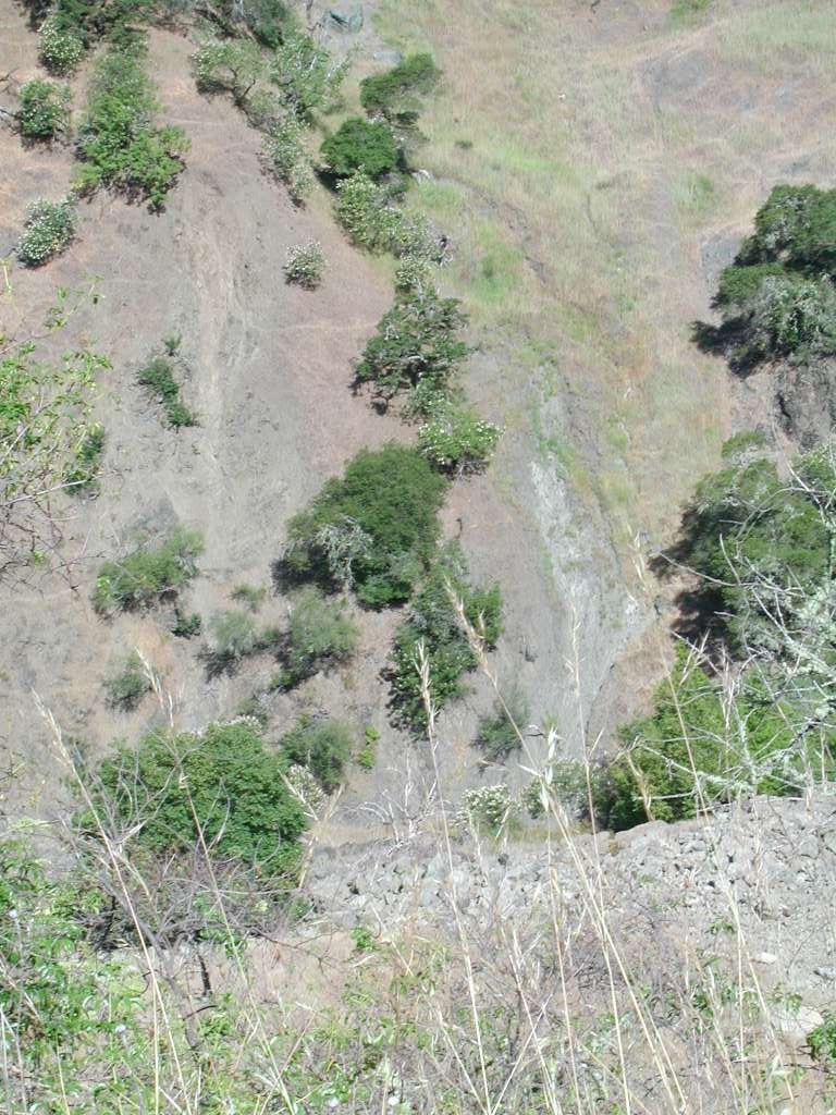
Close up of trails related to grazing. This degree of soil compaction may change runoff patterns in the Soda Creek and Anderson Creek watersheds, making flood peaks higher and base flows lower. Photo by Pat Higgins, June 12, 2002.
To learn more about this topic click Info Links
To view additional information (data source, aquisition date etc.) about this page, click Metadata

 Click on image to enlarge (49K). Click here to display a larger version (157K).
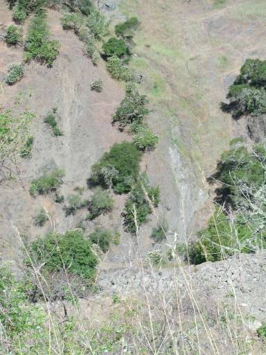 Click on image to enlarge (45K). Click here to display a larger version (248K).
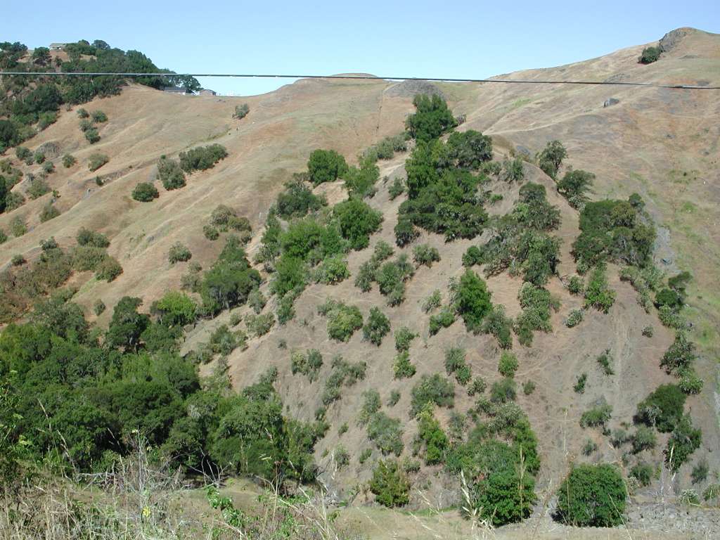 Click on image to enlarge (127K).
 Click on image to enlarge (137K).
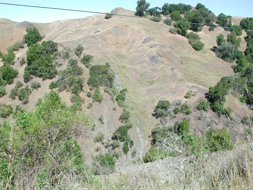