| Area |
Anderson Creek |
| Topic |
Tour: Anderson Creek Streamside Slides June 2002 Part 2 |
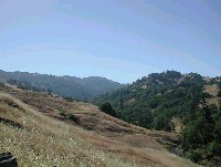
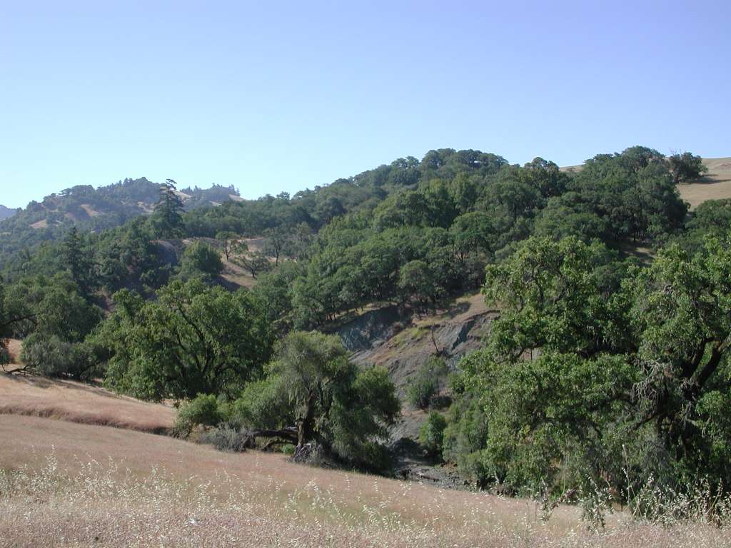
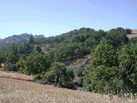 Click on image to enlarge (107K).
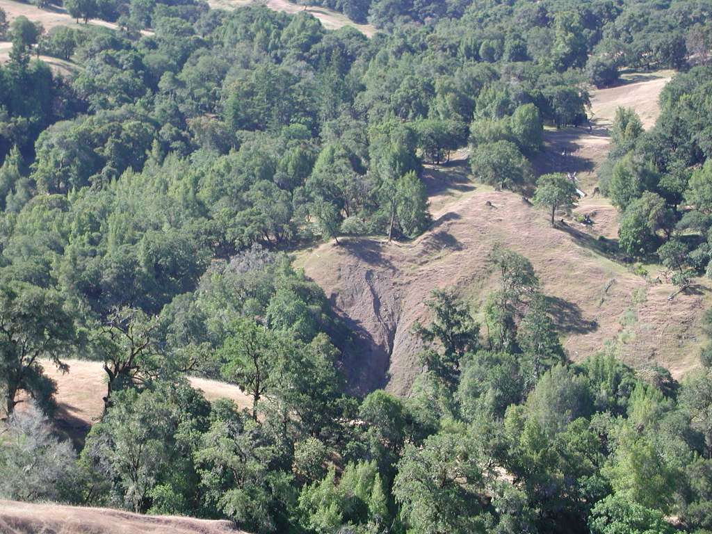
This photo looking upstream on Anderson Creek shows a major streamside landslide, a common feature in the mélange terrain of upper Anderson Creek and Soda Creek. See Picture #2 for a close up of the slide. Photo by Pat Higgins, 6/12/02.
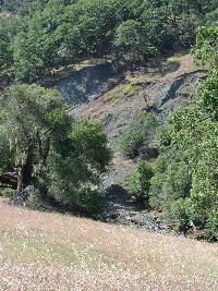 Click on image to enlarge (52K). Click here to display a larger version (313K).
Close up of streamside landslide along upper Anderson Creek with oak woodlands holding the soil further upslope. Streamside landslides and inner gorge failure can be triggered by high flows and bedload transport related to cumulative watershed effects. Once these features are activated, the tend to be reactivated by erosion at their toe in subsequent storms. Photo by Pat Higgins, 6/12/02.
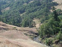
 Click on image to enlarge (81K).
Looking upstream on Anderson Creek, the hill slope to the east (left) has the form of a large earthflow with emerging ground water and hummocks indicating active movement. See Picture #4 for a close up of the earthflow. Photo by Pat Higgins, 6/12/02.
 Click on image to enlarge (52K). Click here to display a larger version (176K).
While the active earthflow just up hill of the upper Anderson Creek channel has grass growing on it, which decreases surface erosion, the entire slope can move at a deeper failure plane. Photo by Pat Higgins, 6/12/02.
 Click on image to enlarge (67K).
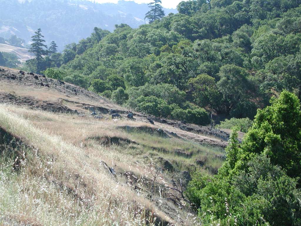
Depression in the landscape t left in middle distance in the photo is the form of a large earthflow, which ends at Anderson Creek at right. See Picture #6 for a close up of the streamside landslide. Photo by Pat Higgins, 6/12/02.
 Click on image to enlarge (124K).
Close up of streamside landslide at the toe of the earthflow shown in Picture #5. Note the parallel lines on the benches just above the creek which are caused by grazing livestock. Photo by Pat Higgins, 6/12/02.
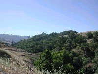
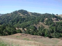 Click on image to enlarge (93K).
Looking southwest at upper Anderson Creek, which is out of view down in the draw. The hillsides here have the characteristic interspersed oak woodlands and grasslands of the Central Belt Franciscan terrain. Note the landslide above the creek just below the center of the photo. See Picture #8 for a close up of the feature. Photo by Pat Higgins, 6/12/02.
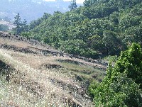
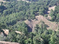 Click on image to enlarge (52K). Click here to display a larger version (160K).
Close up of streamside landslide in the inner gorge of Anderson Creek, which is a zoom on part of Picture #7. Linear trail system on slope above failure suggests grazing activity. Photo by Pat Higgins, 6/12/02.
To learn more about this topic click Info Links
To view additional information (data source, aquisition date etc.) about this page, click Metadata

 Click on image to enlarge (107K).
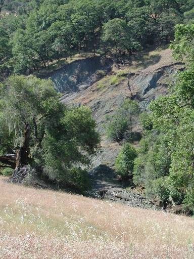 Click on image to enlarge (52K). Click here to display a larger version (313K).
 Click on image to enlarge (81K).
 Click on image to enlarge (52K). Click here to display a larger version (176K).
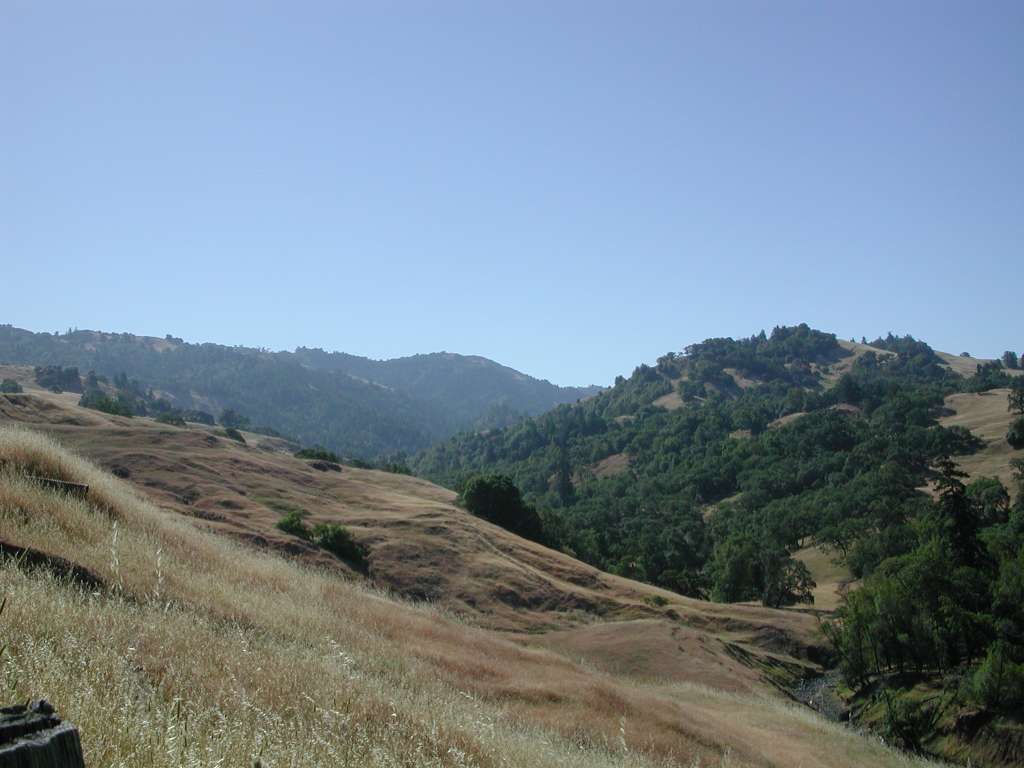 Click on image to enlarge (67K).
 Click on image to enlarge (124K).
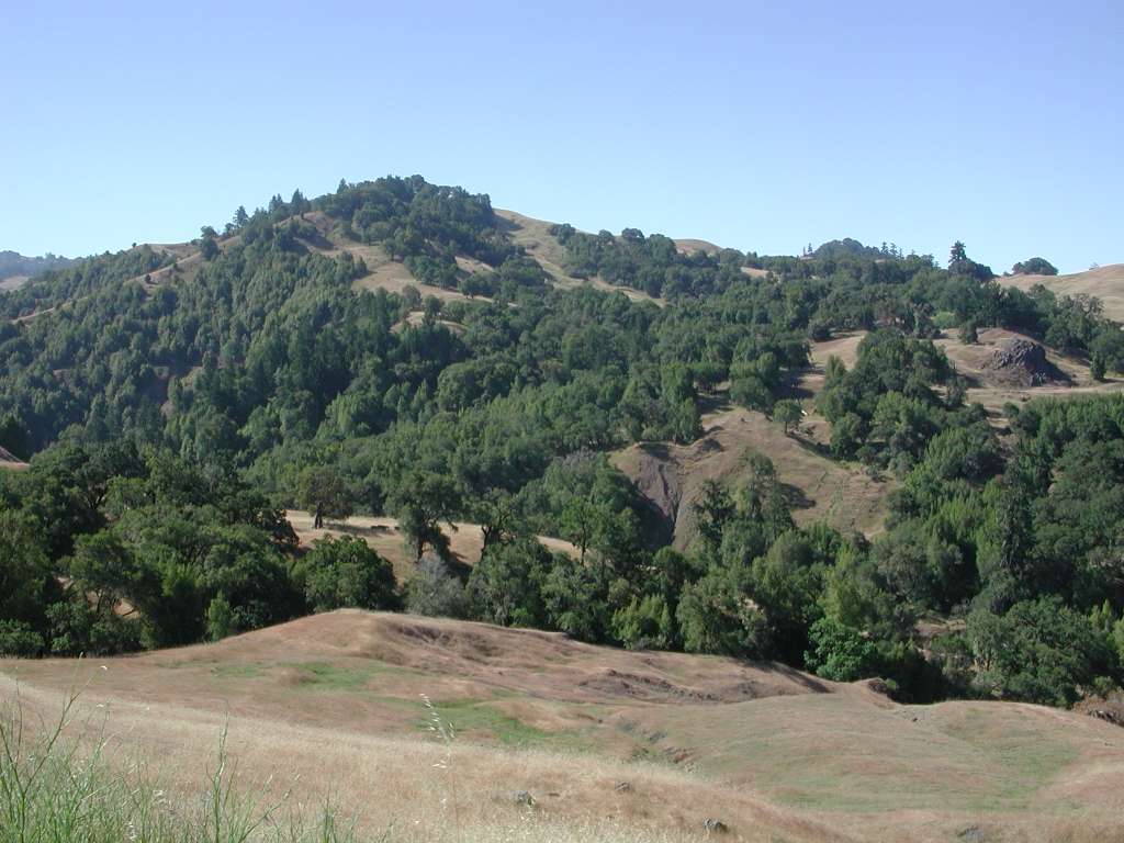 Click on image to enlarge (93K).
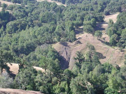 Click on image to enlarge (52K). Click here to display a larger version (160K).
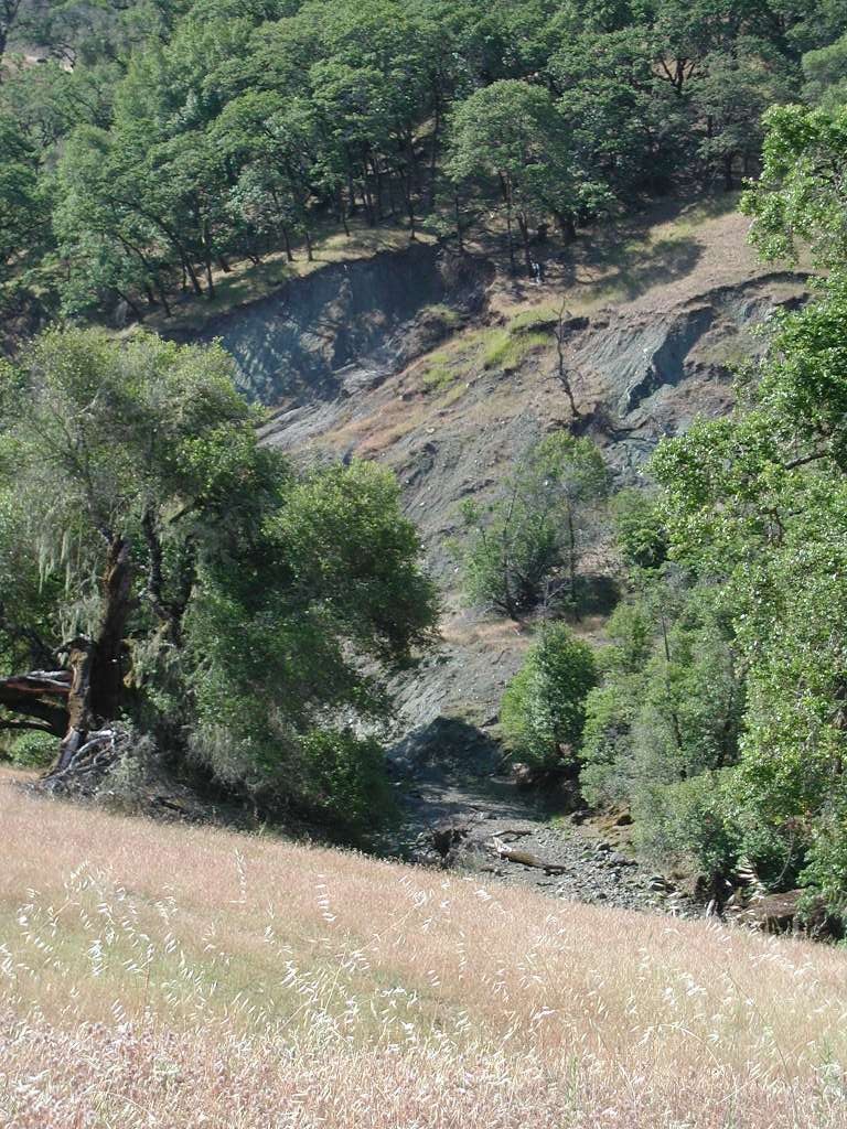