| Area |
Anderson Creek |
| Topic |
Tour: Anderson Creek Upland Grazing June 2002 |
 Click on image to enlarge (59K). Click here to display a larger version (183K).
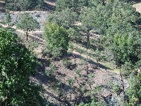
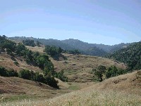
This photo shows the hillslope in mélange terrain on the west slope of upper Anderson Valley Creek with oak woodland and grassy areas. Note the Serpentine bald area with green soils and little vegetation. These areas are sheared material and highly erodible. Serpentine soils may have high amounts of magnesium which blocks calcium uptake by plants and causes vegetation to stunt or fail. Note linear features in the lower part of the photos which are tracks from livestock. Photo courtesy of Pat Higgins, 6/12/02.
 Click on image to enlarge (78K).
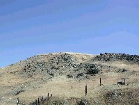
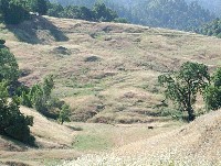
This photo shows a hillslope in mélange terrain just to the north of Highway 253 in upper Anderson Valley. The bald rocky area may be natural as a result of rocky, serpentine soils or may have been in part caused by grazing. See Picture #3 for a close up of the rocky area. Photo courtesy of Pat Higgins, 6/12/02.
 Click on image to enlarge (122K).
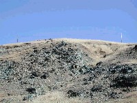
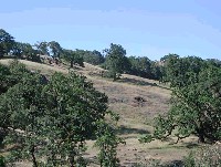
This picture is a zoom in on the previous photo. The bald rocky area may be natural as a result of rocky, serpentine soils or may have been in part caused by grazing. Photo courtesy of Pat Higgins, 6/12/02.
 Click on image to enlarge (71K).
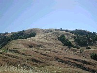
Highway 253 is just out of this photo to the left, which was taken looking east in the upper Anderson Creek watershed. Trails from livestock are visible in hillslopes, especially at lower left, but gullies in the photo may be caused by roads (see Tour: Anderson/Soda Creek Upland Erosion from Roads June 2002). See Picture #5 for the area to the right and downhill (note oak on ridge at far right which shows at far left in next picture). Photo by Pat Higgins, 6/12/02.
 Click on image to enlarge (73K).
This photo was taken looking east up Anderson Creek, immediately adjacent to Picture #4 but down hill. The hummocky terrain is indicative of earthflows. Note grazing cows in the hollow. See Picture #6 for a zoom close up of hollow. Photo by Pat Higgins, 6/12/02.
 Click on image to enlarge (126K).
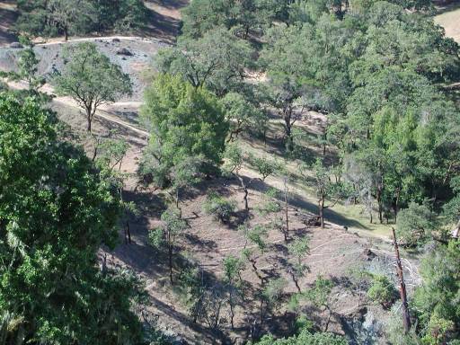
Earthflows often have emerging ground water due to poor percolation in sheared soils, which show here as green areas in the hollow. Earthflow terrain is also very subject to gullying. Photo by Pat Higgins, June 12, 2002.
 Click on image to enlarge (122K).
Hillslope in oak woodlands and grasslands in the upper Anderson Creek watershed showing signs of grazing (trails show as linear features). Compaction due to grazing during wet periods may change runoff characteristics of the watershed. Photo by Pat Higgins, June 12, 2002.
To learn more about this topic click Info Links
To view additional information (data source, aquisition date etc.) about this page, click Metadata

 Click on image to enlarge (59K). Click here to display a larger version (183K).
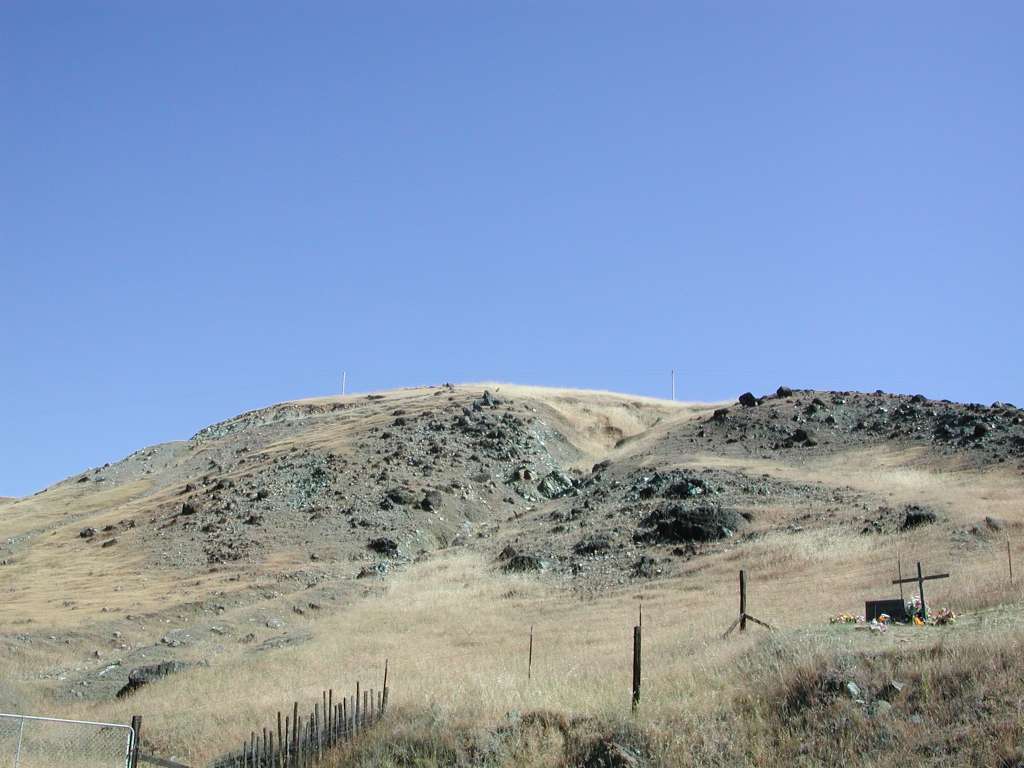 Click on image to enlarge (78K).
 Click on image to enlarge (122K).
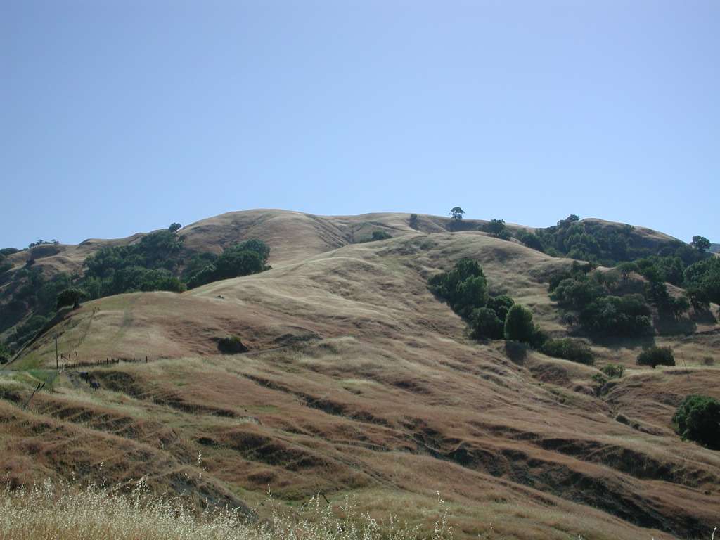 Click on image to enlarge (71K).
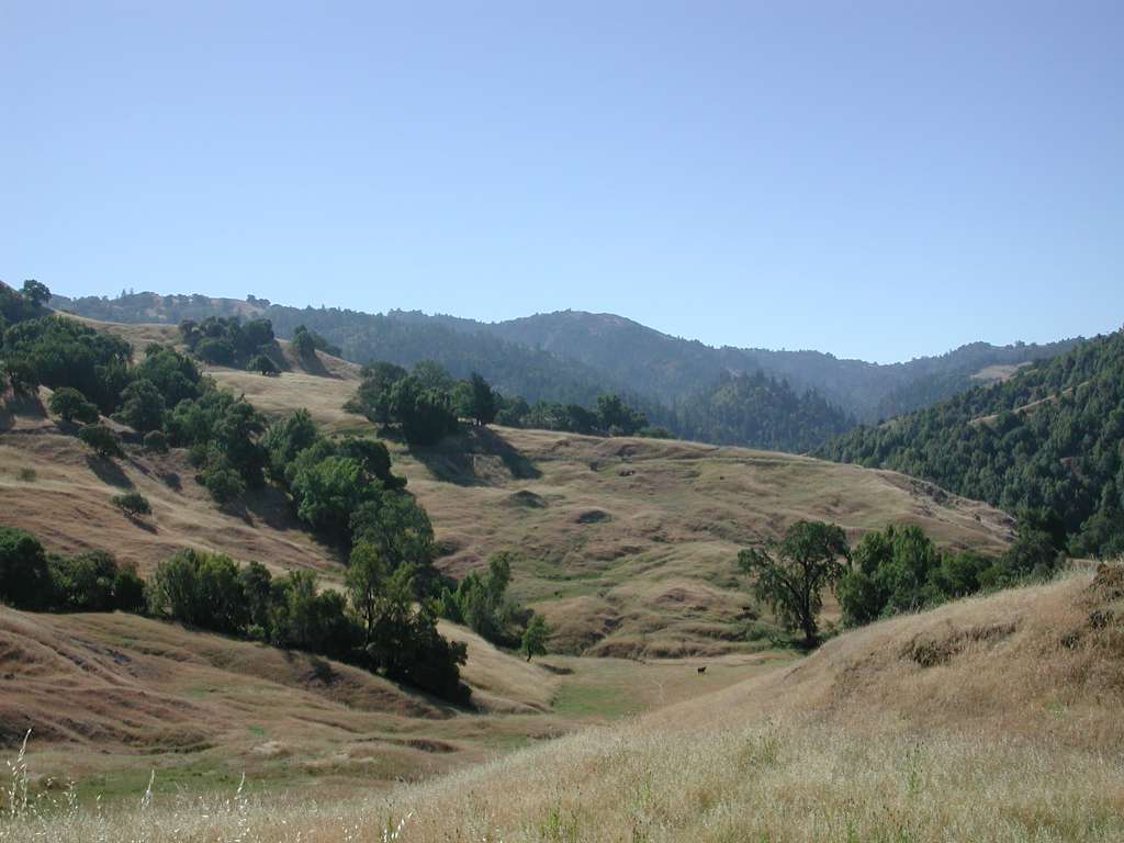 Click on image to enlarge (73K).
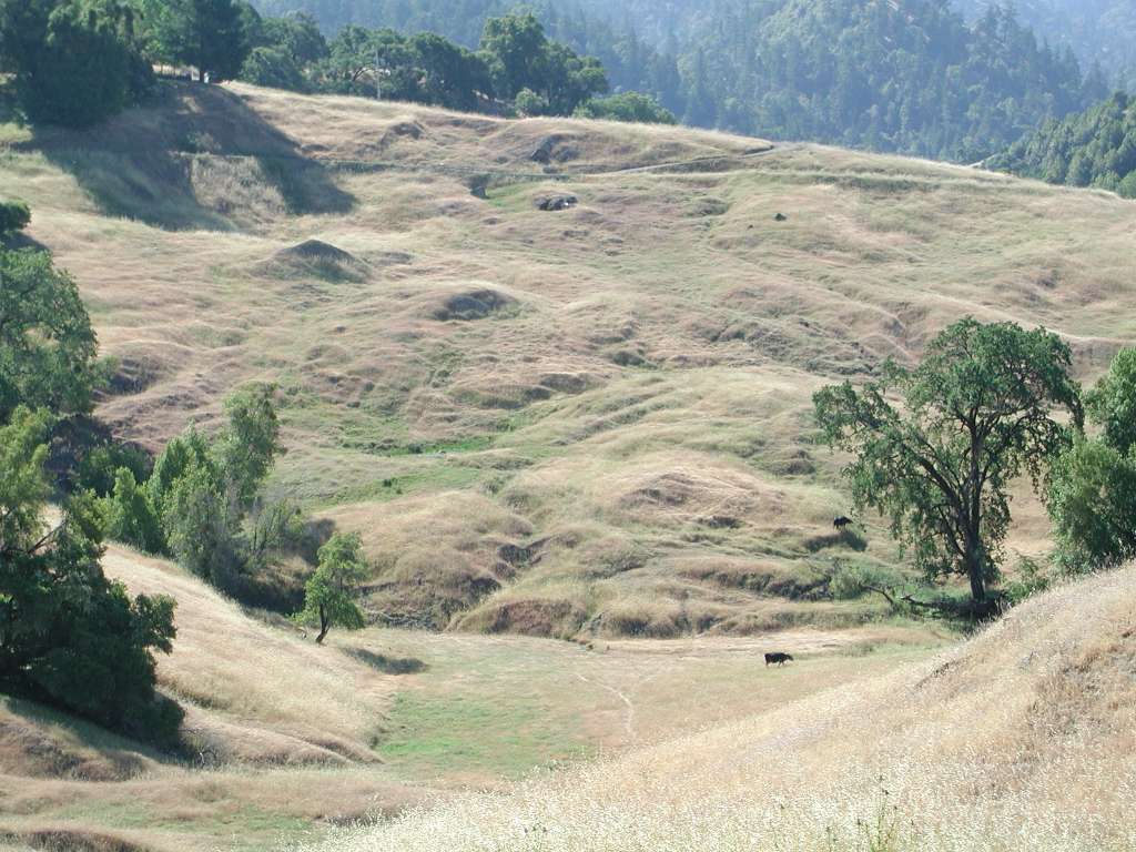 Click on image to enlarge (126K).
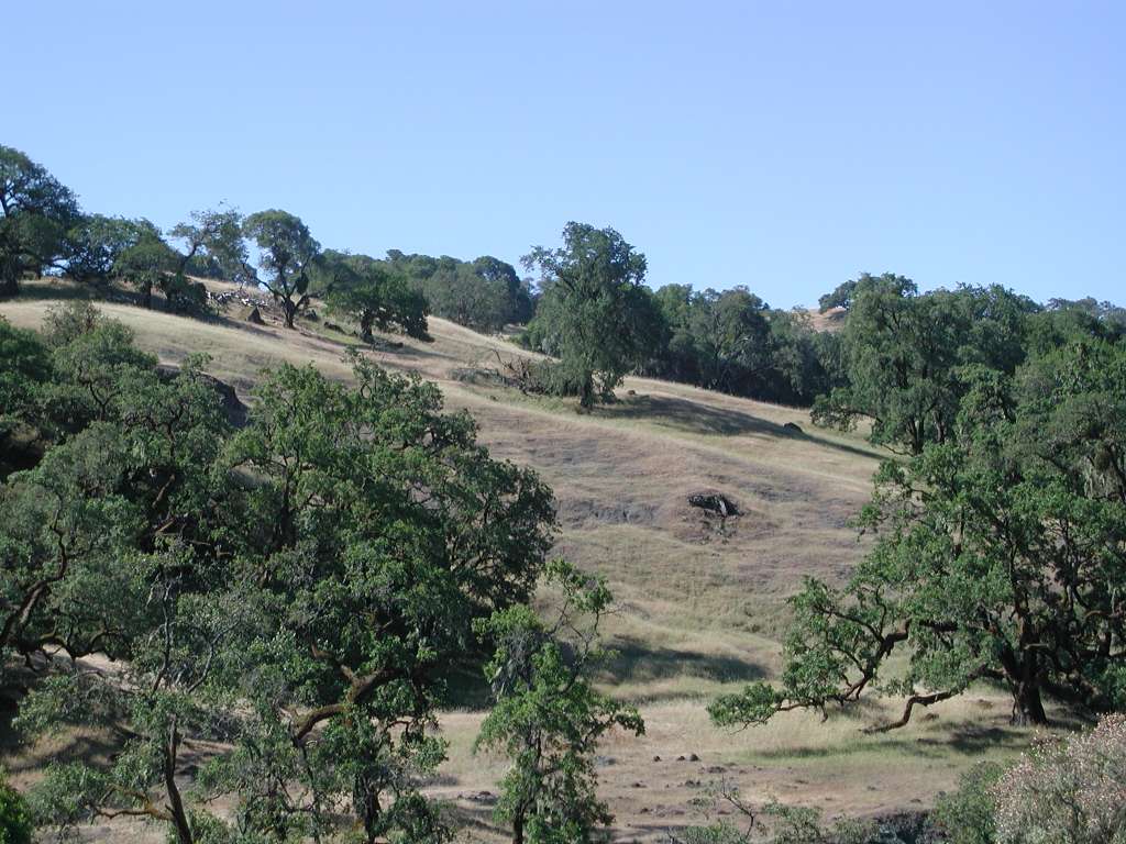 Click on image to enlarge (122K).