| Area |
Anderson Creek |
| Topic |
Tour: Anderson/Soda Creek Stream Channel Photos June 2002 |
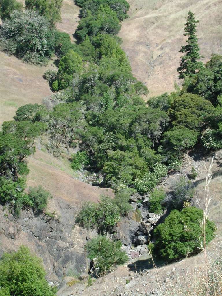
 Click on image to enlarge (60K). Click here to display a larger version (199K).
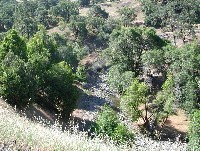
Anderson Creek is shown in this photo upstream of Highway 253. While creeks in mélange terrain are more open than those in coniferous forests, therefore more subject to warming, the wide stream channel here appears to be altered as a result of past flood damage. The wide, shallow channel is likely the result of past aggradation and flood damage. Streams with a high width to depth ratio warm more easily than narrow, deep creeks. The photo water taken looking upstream. Photo by Pat Higgins, June 12, 2002.
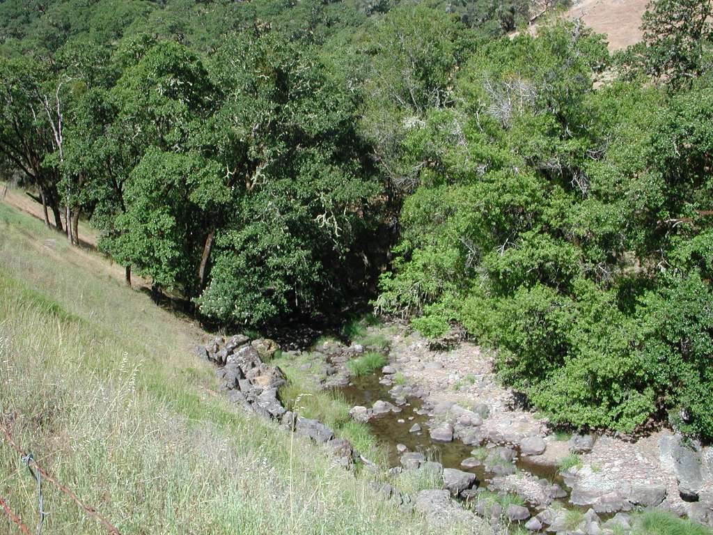
 Click on image to enlarge (64K). Click here to display a larger version (218K).
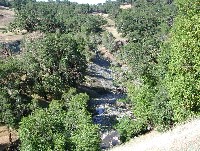
This photo was taken from the same location as Picture #1 looking downstream. Photo by Pat Higgins, June 12, 2002.
 Click on image to enlarge (49K). Click here to display a larger version (272K).
Soda Creek cascades through boulder roughs down hill of Highway 253. This reach would make for difficult passage for anadromous fish. Photo by Pat Higgins, June 12, 2002.
 Click on image to enlarge (60K). Click here to display a larger version (204K).
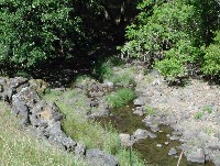
Flat reach of Soda Creek adjacent to Highway 253 upstream of the area depicted in Picture #3. See Picture #5 for a close up of the channel here. Photo by Pat Higgins, June 12, 2002.taken
 Click on image to enlarge (149K).
Soda Creek close up of reach adjacent to Highway 253 (same as Picture #4). Large substrate indicates that this is a high energy reach and bank armoring on the near side for erosion control and protection of the highway. Photo by Pat Higgins, June 12, 2002.
 Click on image to enlarge (135K).
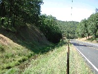
Upper Soda Creek runs parallel to Highway 253 in this photo in a bed that lacks meanders as a result of road construction. Photo by Pat Higgins, June 12, 2002.
 Click on image to enlarge (61K). Click here to display a larger version (205K).
Close up of Soda Creek taken from the shoulder of Highway 253. This area has good herbaceous and woody riparian vegetation which would prevent surface and bank erosion. Photo by Pat Higgins, June 12, 2002.
 Click on image to enlarge (52K). Click here to display a larger version (169K).
Close up of Soda Creek at same location as Picture #7. Photo by Pat Higgins, June 12, 2002.
To learn more about this topic click Info Links
To view additional information (data source, aquisition date etc.) about this page, click Metadata

 Click on image to enlarge (60K). Click here to display a larger version (199K).
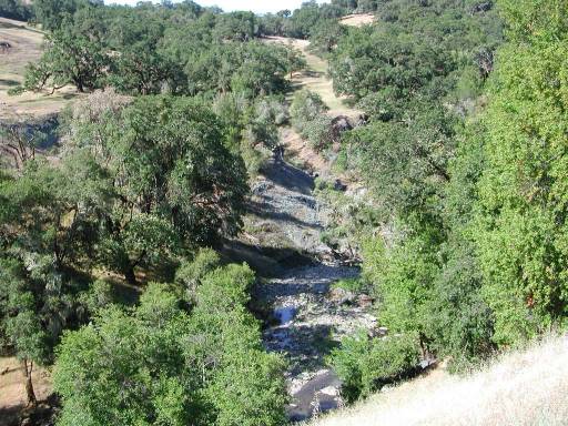 Click on image to enlarge (64K). Click here to display a larger version (218K).
 Click on image to enlarge (49K). Click here to display a larger version (272K).
 Click on image to enlarge (60K). Click here to display a larger version (204K).
 Click on image to enlarge (149K).
 Click on image to enlarge (135K).
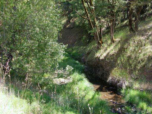 Click on image to enlarge (61K). Click here to display a larger version (205K).
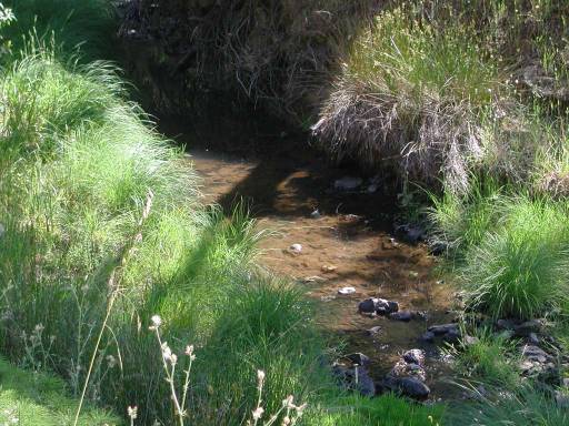 Click on image to enlarge (52K). Click here to display a larger version (169K).
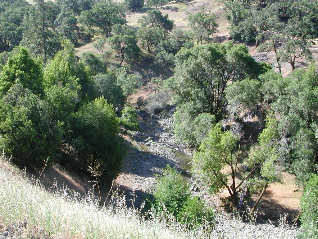