| Area |
Anderson Creek |
| Topic |
Tour: Anderson/Soda Creek Upland Erosion from Roads |
 Click on image to enlarge (38K). Click here to display a larger version (245K).
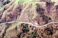
Aerial photo of Highway 253 crossing earthflows in the Soda Creek gorge east of Boonville. The highway has caused major problems with accelerated erosion from gullies and landslides. Photo by Dan Sicular, spring 1997.
 Click on image to enlarge (70K).
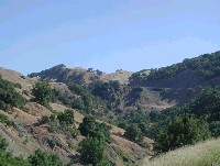
Ground photo of the same area as shown in Picture #1 looking east (upstream) in the Soda Creek drainage east of Boonville. Note Highway 253 along the hillslope to the right with a bridge constructed at one place crossing an earthflow. Note that there has been extensive inner gorge failure along Soda Creek. Photo by Pat Higgins, June 12, 2002.
 Click on image to enlarge (86K).
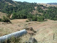
Culvert at the junction of rural road extending east and Highway 253, which is just out of the photo to the left. The force of water during storm events coming out of the culvert has caused erosion (see Picture #4). Photo by Pat Higgins, June 12, 2002.
 Click on image to enlarge (142K).
Looking west downhill below culvert with substantial gully. Gully erosion is a very significant contributor of sediment in the Central Belt melange terrain of upper Anderson Creek. Photo by Pat Higgins, June 12, 2002.
 Click on image to enlarge (62K). Click here to display a larger version (374K).
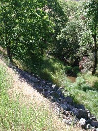
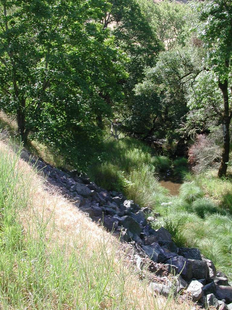
This photo shows upper Soda Creek off of Highway 253 with rip rap being used to stabilize the toe of the fill from the construction of the road. The stream channel here has been altered because the encroachment of the fill has constricted the creek. Photo by Pat Higgins, June 12, 2002.
 Click on image to enlarge (47K). Click here to display a larger version (158K).
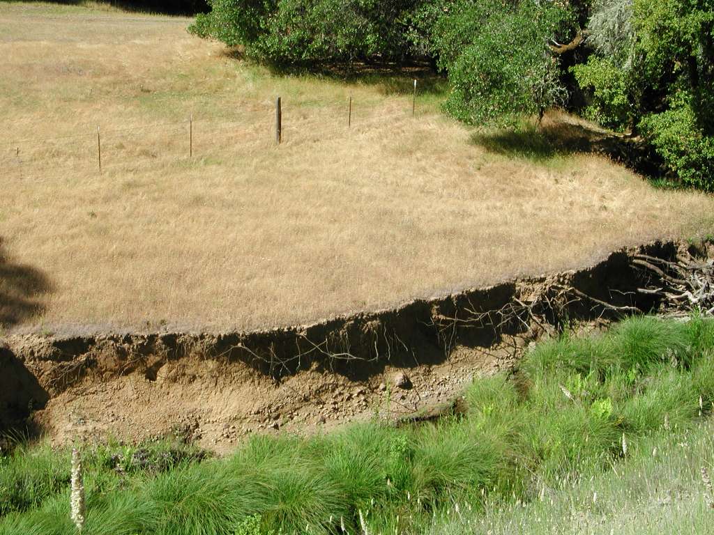
This photo is of the opposite bank just downstream of the rip rap structure in Picture #5. The restricted channel above caused an increase in velocity and deflection of current onto this bank causing it to erode and the channel to downcut. Photo by Pat Higgins, June 12, 2002.
 Click on image to enlarge (131K).
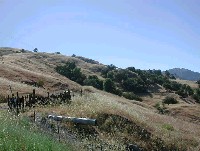
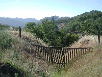
This gate to prevent stock from coming onto Highway 253 sits in a gully which may have been in part caused by the road. The gully has been treated, however, with the downspouts armored to prevent further erosion. Photo by Pat Higgins, June 12, 2002.
 Click on image to enlarge (108K).
Gully in the cutslope of Highway 253. Photo by Pat Higgins, June 12, 2002.
To learn more about this topic click Info Links
To view additional information (data source, aquisition date etc.) about this page, click Metadata

 Click on image to enlarge (38K). Click here to display a larger version (245K).
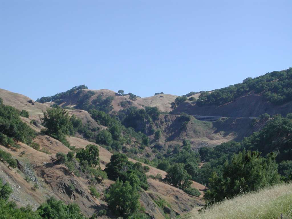 Click on image to enlarge (70K).
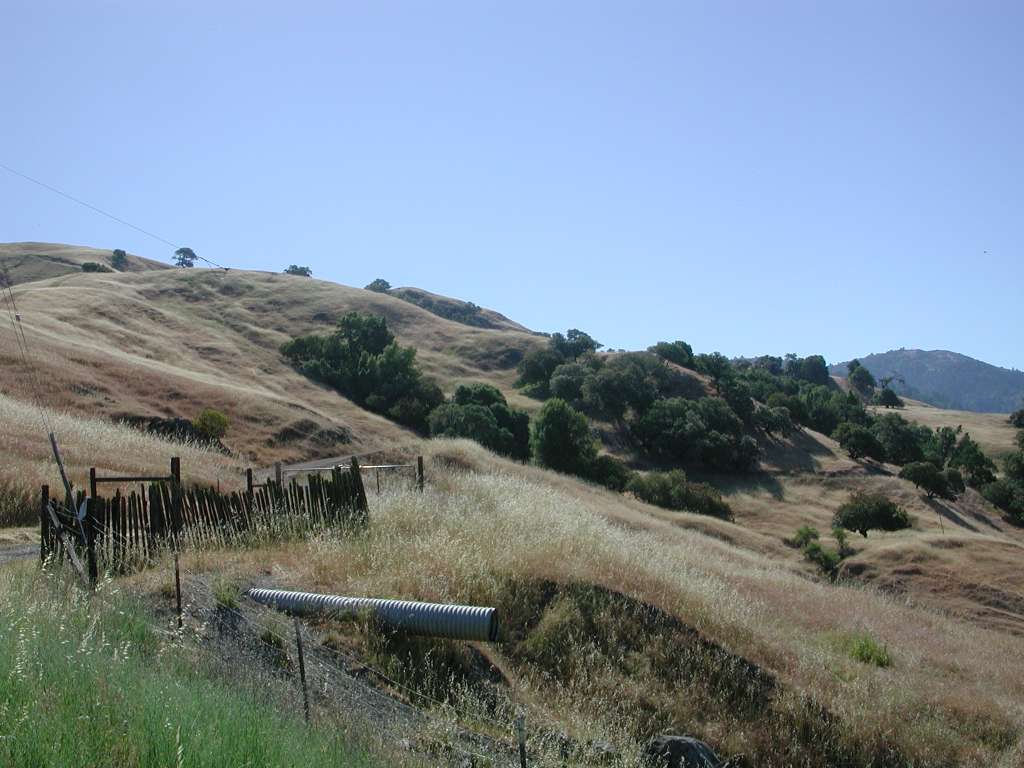 Click on image to enlarge (86K).
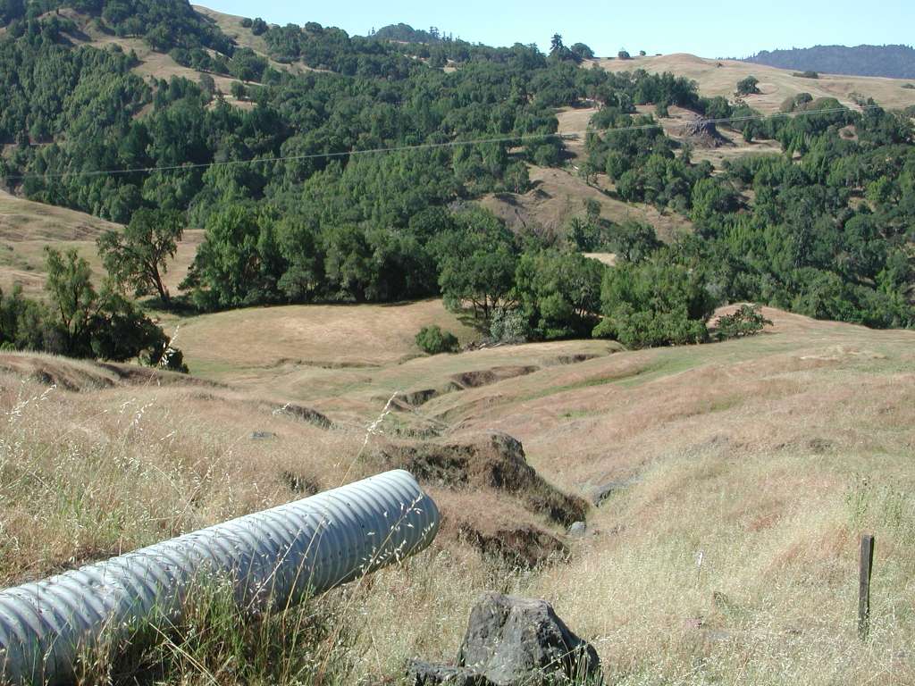 Click on image to enlarge (142K).
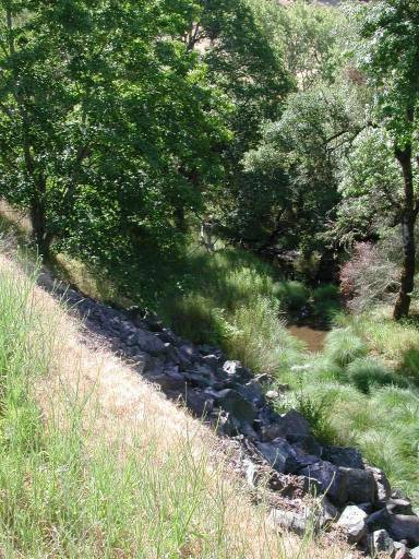 Click on image to enlarge (62K). Click here to display a larger version (374K).
 Click on image to enlarge (47K). Click here to display a larger version (158K).
 Click on image to enlarge (131K).
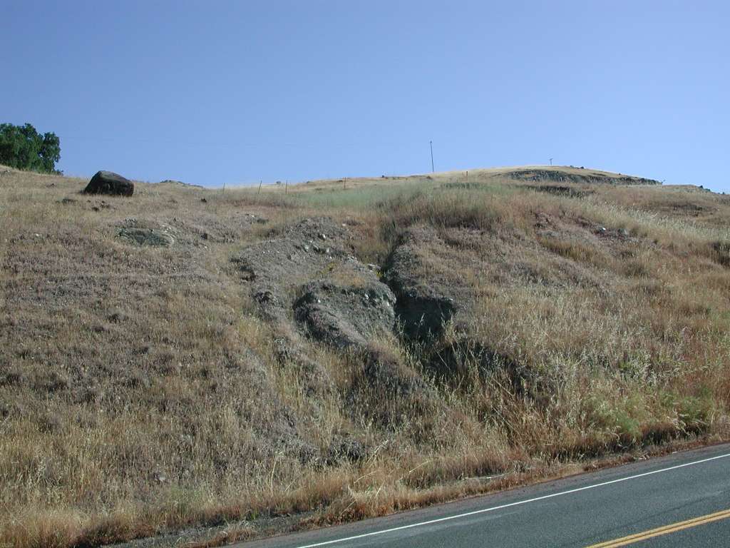 Click on image to enlarge (108K).
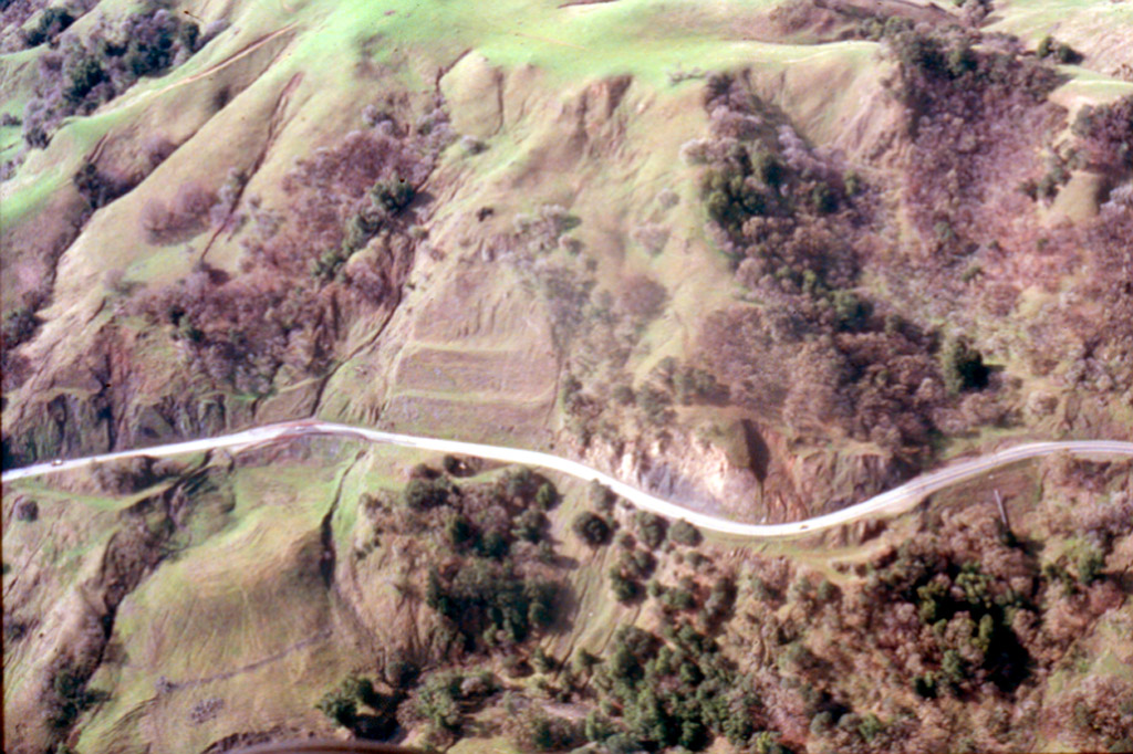