
| Area | Basinwide |
| Topic | Climate: Annual Rainfall in Fort Bragg 1898-1999 |
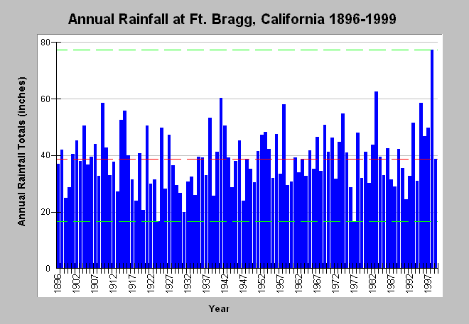
| Caption: The chart shows annual rainfall in inches in Ft. Bragg, California from 1896 to 1999, which is one of the longer rainfall data records for the Mendocino Coast. Bounding lines show highest (77.31 inches) and lowest rainfall (16.56 inches) totals with red line indicating mean annual rainfall (about 39 inches). Wet years are more likely to trigger erosion than dry, although storm intensity and landscape conditions are also significant factors. See (Climate: Peak Daily Rainfall Ft Bragg). | |
 |
To learn more about this topic click Info Links .
To view additional information (data source, aquisition date etc.) about this page, click Metadata .
To view the table with the chart's data, click Chart Table web page.
To download the table with the chart's data, click rainanfb.dbf (size 5,280 bytes) .
To view the table with the chart's source data, click Source Table web page.
To download the table with the chart's source data, click rainann.dbf (size 3,760 bytes)
| www.krisweb.com |