
| Area | Basinwide |
| Topic | Sediment: Road Densities for All Navarro River Planning Watersheds |
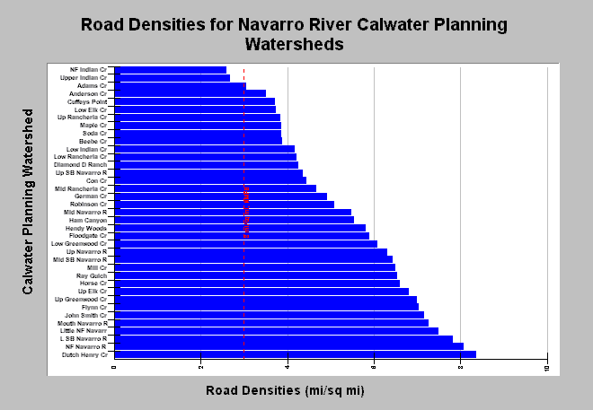
| Caption: The chart shows the density of roads in miles per square mile for all Navarro River Calwater planning watersheds, including those in Elk and Greenwood Creeks outside the Navarro basin proper. The highest road densities tend to be in the northern basins where industrial timber harvest is the primary land use but lower in the eastern Navarro watershed where unstable terrain of the Central Belt Franciscan Formation predominates. The threshold of three miles per square mile comes from NMFS (1996) guidelines. Roads mapped by UC Davis ICE for NCRWQCB as part of TMDL and densities calculated by KRIS IFR staff in Arc Info. See Info Links for more information. See Map for spatial data. | |
 |
To learn more about this topic click Info Links .
To view additional information (data source, aquisition date etc.) about this page, click Metadata .
To view the table with the chart's data, click Chart Table web page.
To download the table with the chart's data, click nav_road_density.xls.db (size 6,144 bytes) .
| www.krisweb.com |