
| Area | Basinwide |
| Topic | Sediment: Road-Related Potential Erosion in Navarro Watershed, Sites |
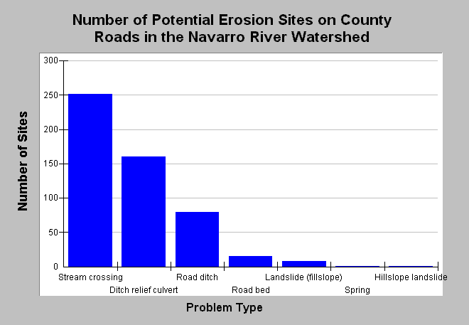
| Caption: This charts shows number of potential erosion sites related to 72.6 miles of Mendocino County roads in the Navarro River watershed that were surveyed in the years 2000 and 2001 as part of the Five Counties Road Erosion Inventory. Stream crossings and ditch relief culverts were the most common problem types. Data were collected by the Mendocino County Department of Transportation, with training and protocol design by Pacific Watershed Associates. Data were provided to KRIS by the Trinity County Planning Department. See Info Links for more information. | |
 |
To learn more about this topic click Info Links .
To view additional information (data source, aquisition date etc.) about this page, click Metadata .
To view the table with the chart's data, click Chart Table web page.
To download the table with the chart's data, click sediment_road_nav_fcrei_00_01.dbf (size 971 bytes) .
| www.krisweb.com |