
| Area | Basinwide |
| Topic | Sediment: TMDL Natural Sources by type 2000 |
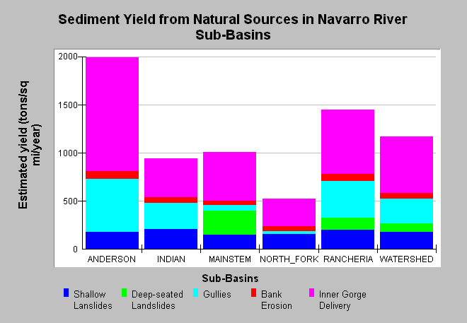
| Caption: The chart shows estimated amounts of naturally occurring sediment in the Navarro River Basin with estimates calculated in tons per square mile per year. "Watershed" on the X-axis is the average for the Navarro Basin over all. Bank erosion and inner gorge failure may also be driven by cumulative watershed effects, but the linkage can't be easily determined and so these categories fall under natural. Data provided in Table 4-1 of the Navarro River TMDL (US EPA, 2000). Click on Info Links for more background information and a link to the report. | |
 |
To learn more about this topic click Info Links .
To view additional information (data source, aquisition date etc.) about this page, click Metadata .
To view the table with the chart's data, click Chart Table web page.
To download the table with the chart's data, click sed_nat_tmdl.dbf (size 532 bytes) .
| www.krisweb.com |