
| Area | Basinwide |
| Topic | Climate: Annual Rainfall in Healdsburg 1878-2000 |
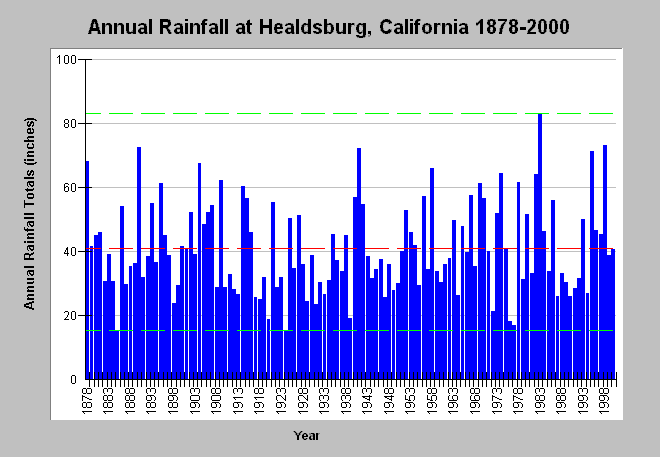
| Caption: The chart shows annual rainfall in inches in Healdsburg, California from 1878-2000. Although this gauge is south and east of the Navarro basin, the long term continuous record is useful for analyzing regional rainfall patterns. Bounding lines show highest (83.3 inches) and lowest rainfall (15.35 inches) totals with red line indicating mean annual rainfall (approximately 41 inches). Wet years are more likely to trigger erosion than dry, although storm intensity and landscape conditions are also significant factors. See Info Links for more information. | |
 |
To learn more about this topic click Info Links .
To view additional information (data source, aquisition date etc.) about this page, click Metadata .
To view the table with the chart's data, click Chart Table web page.
To download the table with the chart's data, click rain_healdsburg.dbf (size 4,066 bytes) .
To view the table with the chart's source data, click Source Table web page.
To download the table with the chart's source data, click rainfall_gualala.dbf (size 5,193 bytes)
| www.krisweb.com |