
|
Area/Topic | Bibliography | Background | Hypotheses | Home |
|
Map Page.
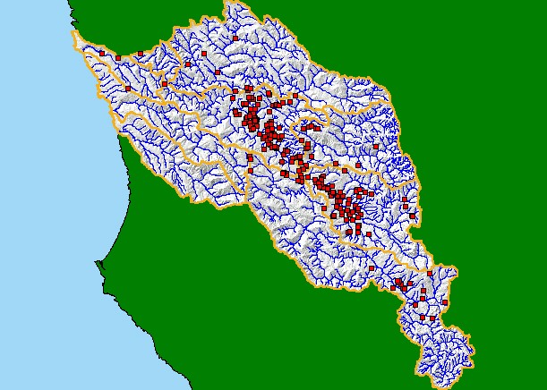
You selected the area Basinwide and the topic Map: 5B Water Rights Locations, Navarro Project Area |
| This is a map of water rights information from the State Water Resources Control Board Division of Water Rights displayed with USGS 1:100,000 hydrography, KRIS sub-basins, and a grayscale hillshade. Water rights listed may not be complete as not all rights are registered, particularly riparian rights. Also, some water users may be extracting water or building retention ponds without permits (SWRCB DWR, 1998). Scale = 1:425,037 . | |||
|
|
||
To view metadata about a map layer, click on a link in the table below.
| Name of Layer in Map Legend | Metadata File Name |
|---|---|
| Water Rights Information | wrims.shp.txt |
| Sub-basins (no labels) | subbasins.shp.txt |
| Project Frame | Unavailable |
| Pacific Ocean | Unavailable |
| Streams (1:24k scale) | streams24.shp.txt |
| Streams (1:100k scale)(no labels) | streams100.shp.txt |
| Topo Map (1:24k scale) | Unavailable |
| Gray Hillshade of Elevtn (TIFF) | grayscale_xnv_light.tif.txt |
| Elevation (10 m resolution)(TIFF) | elev10.tif.txt |
| www.krisweb.com |