
|
Area/Topic | Bibliography | Background | Hypotheses | Home |
|
Map Page.
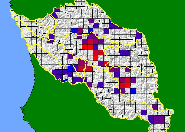
You selected the area Basinwide and the topic Pesticides: Amount Applied in Navarro Project Area, by Chemical 2001 |
| This map shows the amount of registered pesticides applied in the KRIS Navarro project area during the year 2001. Data are from the California Pesticide Use Reporting Database, which was assembled by the California Department of Pesticide Regulation. See Info Links for more information. | |||
|
|
||
To view metadata about a map layer, click on a link in the table below.
| Name of Layer in Map Legend | Metadata File Name |
|---|---|
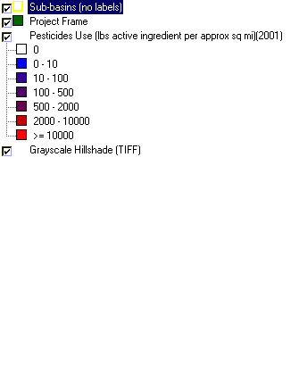
| Sub-basins (no labels) | subbasins.shp.txt |
| Project Frame | Unavailable |
| Pesticides Use (lbs active ingredient per approx sq mi)(2001) | pesticides_dpr_2001.shp.txt |
| EPA Landcover (1992 Aggregated) | lndcov2.tif.txt |
| Topo Map (1:24k scale) | Unavailable |
| Grayscale Hillshade (TIFF) | grayscale_xnv_light.tif.txt |
| Elevation (TIFF) | elev10.tif.txt |
| www.krisweb.com |