
|
Area/Topic | Bibliography | Background | Hypotheses | Home |
|
Map Page.
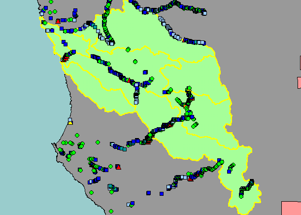
You selected the area Basinwide and the topic Sediment: Road-Related Potential Erosion in Navarro Watershed, Sites |
| This is a map of potential erosion sources related to Mendocino County roads in the Navarro River watershed, based on road survey data collected in the years 2000 and 2001 as part of the Five Counties Road Erosion Inventory. Data were collected by the Mendocino County Department of Transportation, with training and protocol design by Pacific Watershed Associates. Data were provided to KRIS by the Trinity County Planning Department. See Info Links for more information. Scale = 1:425,037 . | |||
|
|
||
To view metadata about a map layer, click on a link in the table below.
| Name of Layer in Map Legend | Metadata File Name |
|---|---|
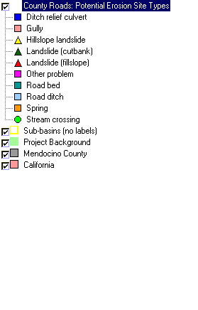
| County Roads: Potential Erosion Site Types | amengis.shp.txt |
| Sub-basins (no labels) | subbasins.shp.txt |
| Topo Map (1:24k scale) | Unavailable |
| Gray Hillshade of Elevtn (TIFF) | grayscale_xnv_light.tif.txt |
| Project Background | Unavailable |
| Mendocino County | Unavailable |
| California | Unavailable |
| www.krisweb.com |