
|
Area/Topic | Bibliography | Background | Hypotheses | Home |
|
Map Page.
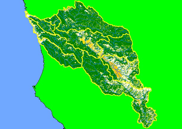
You selected the area Basinwide and the topic Map: 1F EPA Landcover/Landuse, Navarro Project Area |
| This is a map of the landcover and land use in the KRIS Navarro Project Area according to U.S. Environmental Protection Agency data based on a 1992 Landsat image. Much of the western, northern and northeastern parts of the project are in coniferous forest. Anderson Valley shows as areas of orchards and vineyards reflecting a pattern of agricultural use. Grasslands and hardwood forest in the east reflect underlying Central Belt Franciscan mťlange terrain. Scale = 1:431,576 . | |||
|
|
||
To view metadata about a map layer, click on a link in the table below.
| Name of Layer in Map Legend | Metadata File Name |
|---|---|
| Sub-basins (no labels) | subbasins.shp.txt |
| Streams (1:100k scale)(no labels) | streams100.shp.txt |
| Project Frame | Unavailable |
| EPA Landcover (1992 Aggregated) | lndcov2.tif.txt |
| EPA Landcover (1992) | lndcov.tif.txt |
| Topo Map (1:24k scale) | Unavailable |
| Project Area Background | Unavailable |
| www.krisweb.com |