|
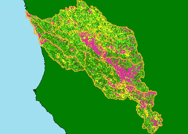
This is a map of 1994 USFS Landsat vegetation size data in the KRIS Navarro Project Area. The tree size classifications used in
the KRIS Navarro project were derived from Landsat multi-spectral images taken in 1994. Stand conditions are accurately
represented at the one hectare scale by the USFS vegetation data. Data are quarried for tree size above. The small diameter tree
size indicates early seral stage conditions in the North Fork and Rancheria Creek basins, reflecting recent timber harvest. The
non-forest areas are agriculture in Anderson Valley and mťlange terrain to the east. Data provided by the U.S. Forest Service
Pacific Southwest Region Remote Sensing Lab, Sacramento, CA. Scale = 1:428,530 .
|
|