|
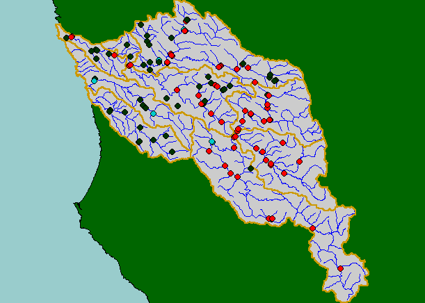
This map shows temperature monitoring stations in the KRIS Navarro project area, displayed with 1:100,000 scale streams and
KRIS sub-basins. Temperature sites are color-coded by their maximum floating weekly average temperature (MWAT). Welsh et
al. (2001) found that coho are not likely to persist where maximum floating weekly average temperature (MWAT) exceeds
16.8°C. IFR used this reference to color code the points above indicating suitability for coho in all, some or no years. Not all
locations may have originally harbored coho juveniles, particularly lower order tributaries in the steep eastern basin. Data were
contributed by Mendocino County Water Agency and Mendocino Redwoods Company.
|
|