| Area |
Basinwide |
| Topic |
Tour: Anderson Valley air photos 2001 |
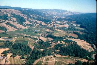 Click on image to enlarge (99K). Click here to display a larger version (429K).
View of the Navarro River basin looking east shows the striking difference between the north and south sides of Anderson Valley. To the right is the lush coniferous forest, and to the left is the more arid oak woodland and grasslands. The valley has been in agriculture since the end of the 19th century, but conversion of agricultural fields to vineyards has accelerated since the 1980s. The light blue ponds which dot the valley are storage ponds for grape irrigation. The mainstem Navarro River flows along the right side of the picture. Pale patches of sediment are visible before the river disappears among the conifers. Photo by Rixanne Wehren, August, 2001.
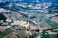
 Click on image to enlarge (102K). Click here to display a larger version (447K).
View of Anderson Valley looking northwest with the Navarro River at lower left in the photo. The grasslands on the east side of the valley are in part due to underlying Central Belt Franciscan mélange terrain while forested areas to the west are mostly in the Coastal Belt. Photo by Rixanne Wehren, August, 2001.
 Click on image to enlarge (110K). Click here to display a larger version (466K).
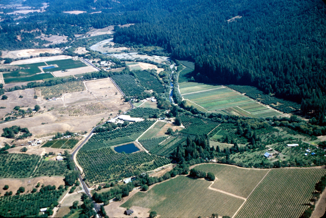
View of the mainstem Navarro River looking upstream with Gowan Orchards in the foreground and Hendy Woods State Park in the background. The riparian buffer on the mainstem consists of a narrow band of hardwood trees, like willow and alder with no larger trees as an over-story below the park. Photo by Rixanne Wehren, Coast Geographics. August, 2001.
 Click on image to enlarge (121K). Click here to display a larger version (521K).
View of the Christine area of the Anderson Valley, between North Fork Soda Creek, Mill Creek and Meyer Gulch.Highway 128 bisects the picture as it runs west to the coast. This photo shows expanding vineyard development in the Navarro River watershed with reservoirs used for irrigation of vineyards dotting the landscape. Photo by Rixanne Wehren, August, 2001.
To learn more about this topic click Info Links
To view additional information (data source, aquisition date etc.) about this page, click Metadata

 Click on image to enlarge (99K). Click here to display a larger version (429K).
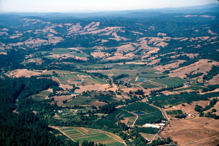 Click on image to enlarge (102K). Click here to display a larger version (447K).
 Click on image to enlarge (110K). Click here to display a larger version (466K).
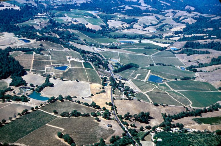 Click on image to enlarge (121K). Click here to display a larger version (521K).
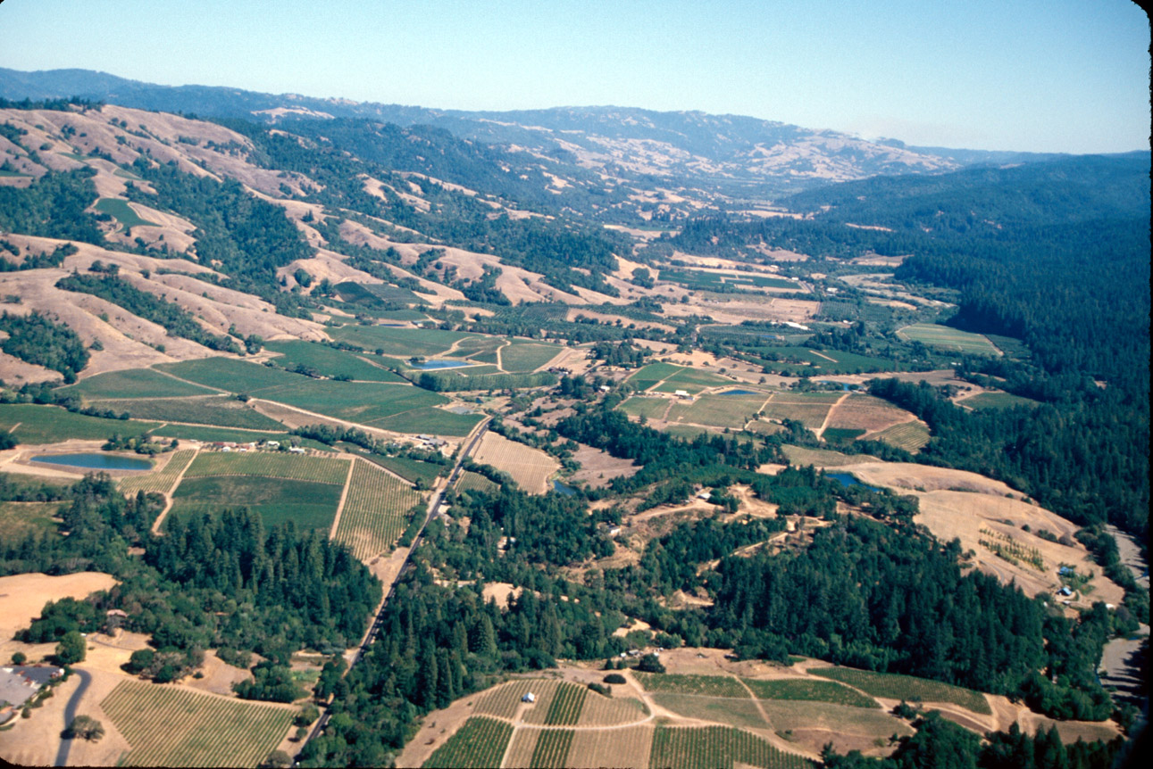