| Area |
Basinwide |
| Topic |
Tour: Masonite Road Construction Photos, Part 1 |
 Click on image to enlarge (125K). Click here to display a larger version (459K).
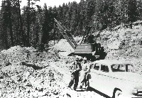
The photo shows Masonite Road construction around 1949. When completed, the road extended from Ukiah to Highway 128 near the town of Navarro and was built for hauling logs from the Navarro woods. The crane in the background is excavating for culvert installation. Collection of the Mendocino County Museum, #1989-11-17. Gift of Roger Krueger/ Louisiana Pacific. Photographer unknown.
 Click on image to enlarge (117K). Click here to display a larger version (421K).
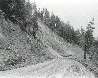
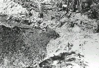
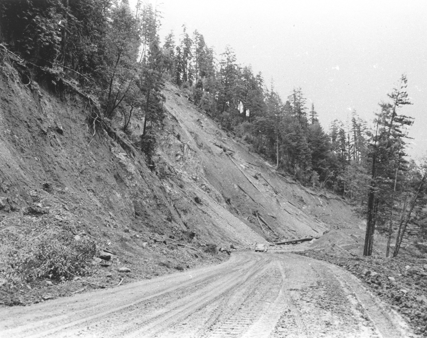
The photo shows a landslide that closed the Masonite Road shortly after construction around 1949. The photo was labeled with, "First large slide area east of Navarro terminus." The road was a major source of erosion to the North Fork Navarro and its tributaries as documented by California Department of Fish and Game memos in the early 1950's (see KRIS Bibliography). Collection of the Mendocino County Museum, #1989-11-106. Gift of Roger Krueger/ Louisiana Pacific. Photographer unknown.
 Click on image to enlarge (151K).
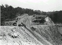
The photo shows Masonite Road construction with side-casting of material on a steep embankment around 1949. Side casting like this created increased debris slide risk. Collection of the Mendocino County Museum, #1989-11-121. Gift of Roger Krueger/ Louisiana Pacific. Photographer unknown.
 Click on image to enlarge (154K).
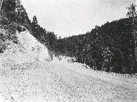
The photo shows a view of the Masonite Road after construction around 1949: "View of Masonite Road along the Little North Fork of the Navarro River approximately 30 miles west of Ukiah. Good stand of old growth redwood timber in background." Collection of the Mendocino County Museum, #1989-11-95. Gift of Roger Krueger/ Louisiana Pacific. Photographer unknown.
 Click on image to enlarge (93K). Click here to display a larger version (185K).
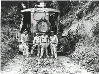
The photo shows Masonite Road construction with road builders standing by their excavator around 1949. Collection of the Mendocino County Museum, #1989-11-104. Gift of Roger Krueger/ Louisiana Pacific. Photographer unknown.
 Click on image to enlarge (95K). Click here to display a larger version (205K).
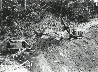
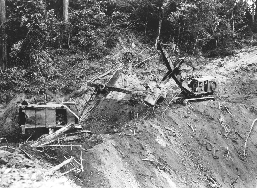
The photo shows Masonite Road construction with two excavators around 1949. Collection of the Mendocino County Museum, #1989-11-106. Gift of Roger Krueger/ Louisiana Pacific. Photographer unknown.
 Click on image to enlarge (106K). Click here to display a larger version (222K).
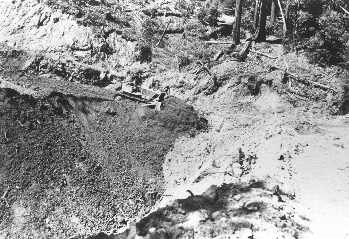
This photo shows Masonite Road construction around 1949 with HD-19 bulldozer covering a culvert ˝ mile east of Smith Creek on main road. Top soil left on steep slopes was easily transported down hill in subsequent major storms. Collection of the Mendocino County Museum, #1989-11-18. Gift of Roger Krueger/ Louisiana Pacific. Photographer unknown.
 Click on image to enlarge (79K). Click here to display a larger version (161K).
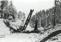
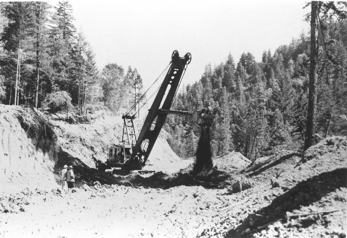
The photo shows Masonite Road construction around 1949 with a 2 ˝ yard shovel on a long boom operating on main road near Smith Creek in the North Fork Navarro drainage. California Department of Fish and Game memos document major damage to this stream as a result of erosion from this road (see KRIS Bibliography). Collection of the Mendocino County Museum, #1989-11-16. Gift of Roger Krueger/ Louisiana Pacific. Photographer unknown.
To learn more about this topic click Info Links
To view additional information (data source, aquisition date etc.) about this page, click Metadata

 Click on image to enlarge (125K). Click here to display a larger version (459K).
 Click on image to enlarge (117K). Click here to display a larger version (421K).
 Click on image to enlarge (151K).
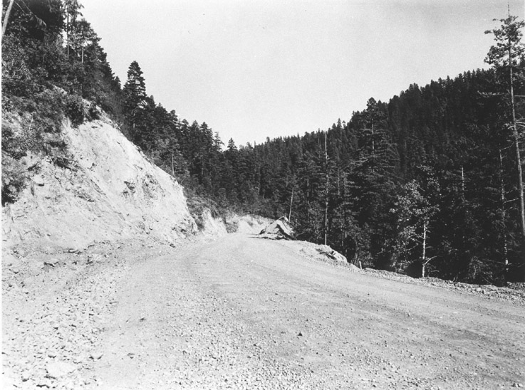 Click on image to enlarge (154K).
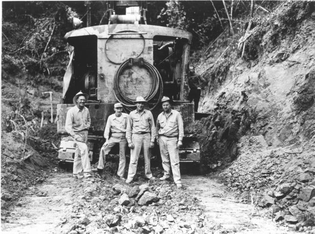 Click on image to enlarge (93K). Click here to display a larger version (185K).
 Click on image to enlarge (95K). Click here to display a larger version (205K).
 Click on image to enlarge (106K). Click here to display a larger version (222K).
 Click on image to enlarge (79K). Click here to display a larger version (161K).
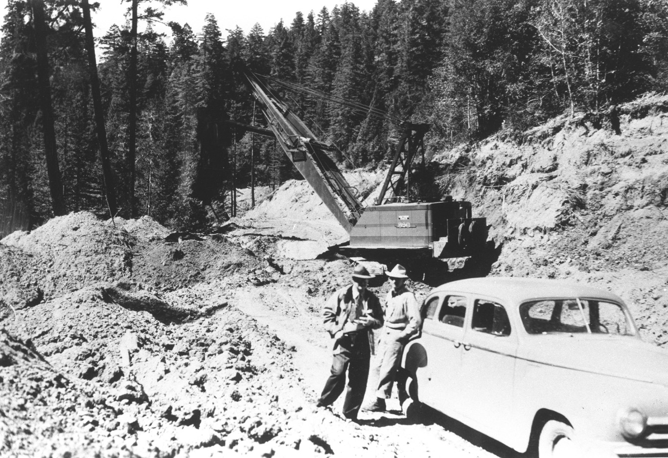