
|
Area/Topic | Bibliography | Background | Hypotheses | Home |
|
Map Page.
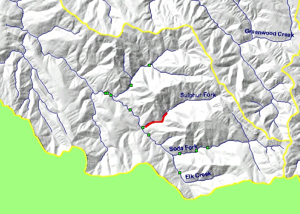
You selected the area Elk Creek and the topic Tour: Soda Creek Logjams 1993 |
| This is a map of the California Habitat Restoration Database (Version 3a) in upper Elk Creek and its tributaries, displayed on top of KRIS sub-basins, 1:24,000 scale hydrography and a grayscale hillshade of elevation. The database shows projects funded by the California Department of Fish and Game's Fisheries Restoration Grants Program. There are two layers: one for points, one for lines. Lines shown in red are hotlinked to photo tours. To view a photo tour, click on a red line. Scale = 1:63,545 . | |||
|
|
||
To view metadata about a map layer, click on a link in the table below.
| Name of Layer in Map Legend | Metadata File Name |
|---|---|
| CA Habitat Restoration Sites - Points | restor_pts_year.shp.txt |
| CA Habitat Restoration Sites - Lines | restor_lns_work.shp.txt |
| Streams (1:24,000 scale)(w/labels) | streams24.shp.txt |
| Subbasin w/o Labels | subbasins.shp.txt |
| Frame Project Outline | Unavailable |
| Topo Map, (1:24k scale) | Unavailable |
| Grayscale Hillshade | grayscale_xnv_light.tif.txt |
| www.krisweb.com |