
|
Area/Topic | Bibliography | Background | Hypotheses | Home |
|
Map Page.
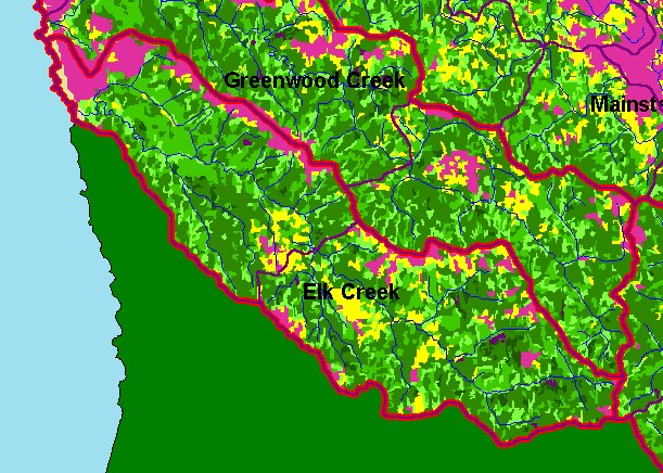
You selected the area Elk Creek and the topic Map: 1F USFS Vegetation Size, Elk Creek Sub-basin |
| This is a map of 1994 Landsat derived vegetation size data for the Elk Creek sub-basin, displayed with USGS 1:100,000 scale streams. Early seral stage conditions represented by widespread areas of small diameter trees indicate recent, active timber harvest. Data provided by the U.S. Forest Service Pacific Southwest Region Remote Sensing Lab, Sacramento, CA. Scale = 1:120,780 . | |||
|
|
||
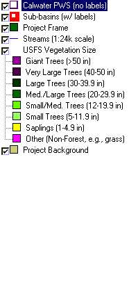
To view metadata about a map layer, click on a link in the table below.
| Name of Layer in Map Legend | Metadata File Name |
|---|---|
| Calwater PWS (no labels) | calw22.shp.txt |
| Sub-basins (w/ labels) | subbasins.shp.txt |
| Project Frame | Unavailable |
| Streams (1:24k scale) | streams24.shp.txt |
| USFS Riparian Veg Size | vegsizebuf.tif.txt |
| USFS Vegetation Size | vegsize.tif.txt |
| Topo Map (1:24k scale) | Unavailable |
| Graycale Hillshade (TIFF) | grayscale_xnv_light.tif.txt |
| Project Background | Unavailable |
| www.krisweb.com |