
| Area | Greenwood Creek |
| Topic | Sediment: Erosion Sources by Percent in Greenwood Creek 1996 |
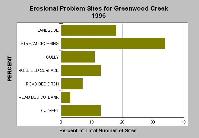
| Caption: This charts shows sources of erosion in Greenwood Creek collected during a road survey in 1996. Stream crossings were the largest source of erosional problems according to the survey. Of the 87 landslides documented, 52 (59%) were related to landing fill failures, 32 (37%) were caused by road failures, and 3 (4%) were attributed to cutbank failure. Data were provided by Forest, Soil and Water. See Info Links for more information. | |
 |
To learn more about this topic click Info Links .
To view additional information (data source, aquisition date etc.) about this page, click Metadata .
To view the table with the chart's data, click Chart Table web page.
To download the table with the chart's data, click fsw_erosion1996.xls.db (size 4,096 bytes) .
| www.krisweb.com |