
|
Area/Topic | Bibliography | Background | Hypotheses | Home |
|
Map Page.
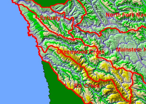
You selected the area Greenwood Creek and the topic Map: 1B Hydrography with DEM, Greenwood Creek Sub-basin |
| This is a map of the 1:100,000 scale USGS hydrography in the Greenwood Creek sub-basin displayed with a Digital Elevation Model (DEM). Ten meter data on which the Digital Elevation Model (DEM) is built are from the California Department of Forestry. Scale = 1:164,713 . | |||
|
|
||
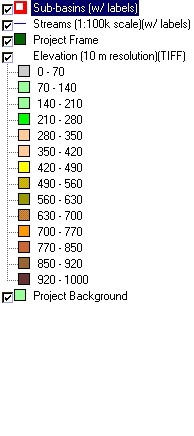
To view metadata about a map layer, click on a link in the table below.
| Name of Layer in Map Legend | Metadata File Name |
|---|---|
| Sub-basins (w/ labels) | subbasins.shp.txt |
| Streams (1:100k scale)(w/ labels) | streams100.shp.txt |
| Project Frame | Unavailable |
| Elevation (10 m resolution)(TIFF) | elev10.tif.txt |
| Topo Map (1:24k scale) | Unavailable |
| Project Background | Unavailable |
| www.krisweb.com |