
|
Area/Topic | Bibliography | Background | Hypotheses | Home |
|
Map Page.
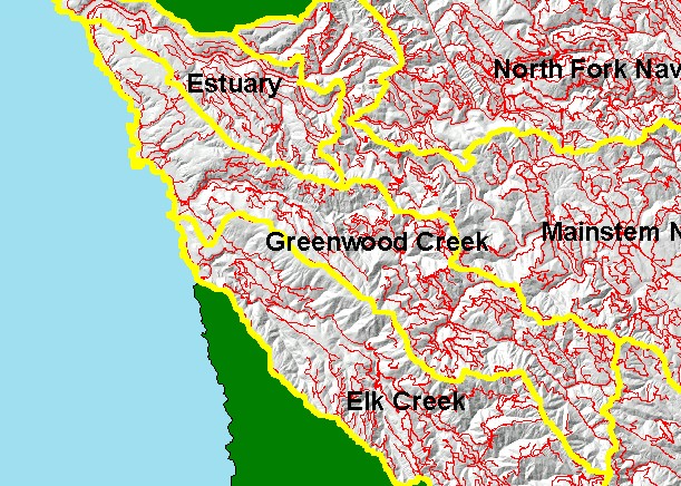
You selected the area Greenwood Creek and the topic Map: 1H Roads, Greenwood Creek Sub-basin |
| This is a map of the Roads in the Greenwood Creek sub-basin, displayed with a Grayscale Hillshade and KRIS sub-basin boundaries. The roads data may under-represent actual roads as only major haul roads are mapped, not temporary roads, skid trails or landings. Data were provided by the California Department of Forestry, Santa Rosa. Greater road densities are related to increased fine sediment yield to streams. | |||
|
|
||
To view metadata about a map layer, click on a link in the table below.
| Name of Layer in Map Legend | Metadata File Name |
|---|---|
| Sub-basins (w/ labels) | subbasins.shp.txt |
| Project Frame | Unavailable |
| Roads (THP) | roads.shp.txt |
| Topo Map (1:24k scale) | Unavailable |
| Gray Hillshade of Elevtn (TIFF) | grayscale_xnv_light.tif.txt |
| Project Background | Unavailable |
| www.krisweb.com |