

|
Area/Topic | Bibliography | Background | Hypotheses | Home |
|
Map Page.
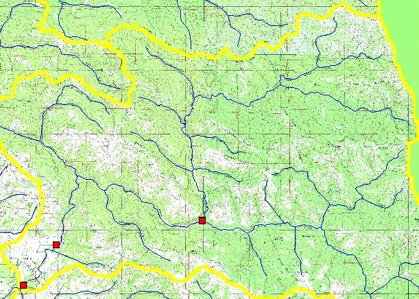
You selected the area Indian Creek and the topic Fish: Snorkel Surveys Indian Creek 2000 Summer |
| This is a map of UC Davis snorkel survey sites displayed with USGS 1:100,000 hydrography and USGS 1:24,000 scale topographic map in the Indian Creek Sub-basin. | |||
|
|
||
To view metadata about a map layer, click on a link in the table below.
| Name of Layer in Map Legend | Metadata File Name |
|---|---|
| UC Davis Survey Sites | ucd_sample_sites.shp.txt |
| Streams (1:100,000 scale) | streams100.shp.txt |
| Subbasin w/ Labels | subbasins.shp.txt |
| Frame Project Outline | Unavailable |
| Topo Map (1:24k scale) | Unavailable |
| www.krisweb.com |