| Area |
Indian Creek |
| Topic |
Tour: Indian Creek Channel Types 1995 |
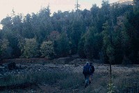
 Click on image to enlarge (75K). Click here to display a larger version (285K).
Indian Creek near furthest upstream extent of the survey by Higgins (1994) in an incised, bedrock gorge. The lack of depth in this extremely high energy reach suggests that sediment supply was still active in October 1995 when this photo was taken. Rosgen B1. Photo by Pat Higgins
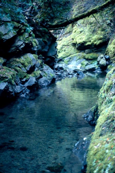
 Click on image to enlarge (77K). Click here to display a larger version (198K).
This photo shows a moderately entrenched channel of Indian Creek in a high gradient riffle. The substrate is a mixture of cobble, boulders and bedrock. The dead tree snag at left of center in the photo defines the old edge of the active channel. Rosgen B2. Photo by Pat Higgins, October 1995.
 Click on image to enlarge (66K). Click here to display a larger version (172K).
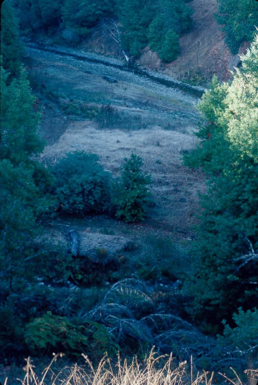
This photo was taken looking down on Indian Creek, which is at the top of the photo. The wide, aggraded channel lacks diversity and represents very poor fish habitat. The high width to depth ratio facilitates stream warming. Rosgen C2. Photo by Pat Higgins, October 1995.
 Click on image to enlarge (128K).
This photo shows a C3 channel type on Indian Creek suffering from acute cumulative watershed effects. This reach is highly aggraded, which has filled pools and created a wide and open flood plane. Before disturbance, reaches such as this would have had complex large wood jams and accumulation of spawning gravels, which would have made ideal salmonid spawning and rearing habitat. The wide channel here is braided and subject to extreme warming. Photo by Pat Higgins, October 1995.
 Click on image to enlarge (139K).
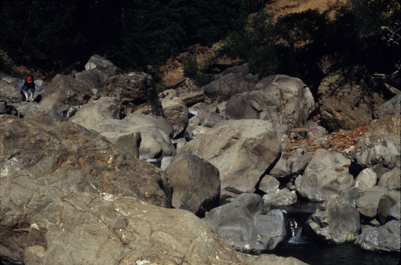
This reach of Indian Creek is a B3 channel type with cobble as the predominant substrate. The landslide downstream on the right is what is known as an inner gorge failure. This type of landslide is the most destructive to a stream because all sediment from the slope is delivered to the stream. It also leaves the riparian hillside bare, which raises local ambient air temperatures and promotes stream warming. Slope failures on the south side in Indian Creek are very xeric (dry) sites and often have not re-established vegetation 20 years after sliding. Photo by Pat Higgins, October 1995.
 Click on image to enlarge (62K). Click here to display a larger version (165K).
This photo shows the North Fork of Indian Creek in a cascade in an area of boulder roughs not far upstream of the convergence of Indian Creek. Rosgen channel type is A2. Photo by Pat Higgins, October 1995.
To learn more about this topic click Info Links
To view additional information (data source, aquisition date etc.) about this page, click Metadata

 Click on image to enlarge (75K). Click here to display a larger version (285K).
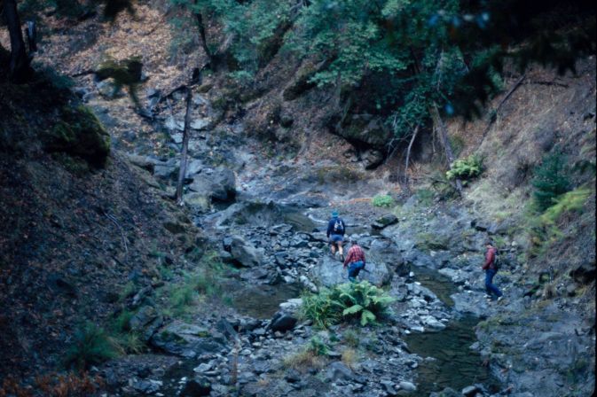 Click on image to enlarge (77K). Click here to display a larger version (198K).
 Click on image to enlarge (66K). Click here to display a larger version (172K).
 Click on image to enlarge (128K).
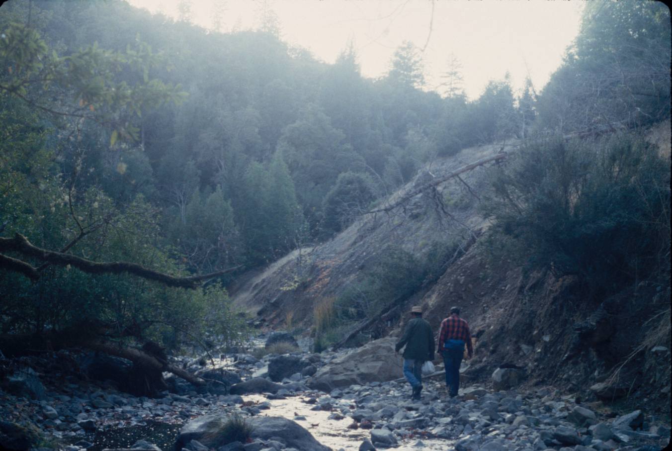 Click on image to enlarge (139K).
 Click on image to enlarge (62K). Click here to display a larger version (165K).
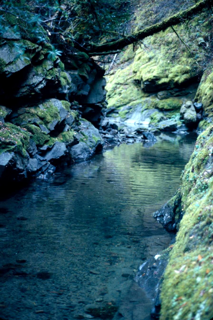