
| Area | Mainstem |
| Topic | Flow: Navarro River - Daily Average, 1951-1964 |
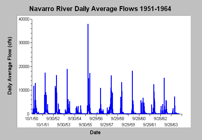
| Caption: This chart displays daily average flows (cfs) for the Navarro River near Navarro, CA (USGS gage # 11468000) between water years 1951 and 1964. The 1955 flood is clearly visible as the highest flow in this period (37,800 cfs). Data are from the US Geological Survey. See Info Links for more information. | |
 |
To learn more about this topic click Info Links .
To view additional information (data source, aquisition date etc.) about this page, click Metadata .
To view the table with the chart's data, click Chart Table web page.
To download the table with the chart's data, click flow_navarro_usgs11468000_1951_1964.dbf (size 184,266 bytes) .
To view the table with the chart's source data, click Source Table web page.
To download the table with the chart's source data, click flow_navarro_usgs11468000_1951_2001.dbf (size 670,770 bytes)
| www.krisweb.com |