
| Area | Mainstem |
| Topic | Flow: Navarro River - Daily Average, 1965-1978 |
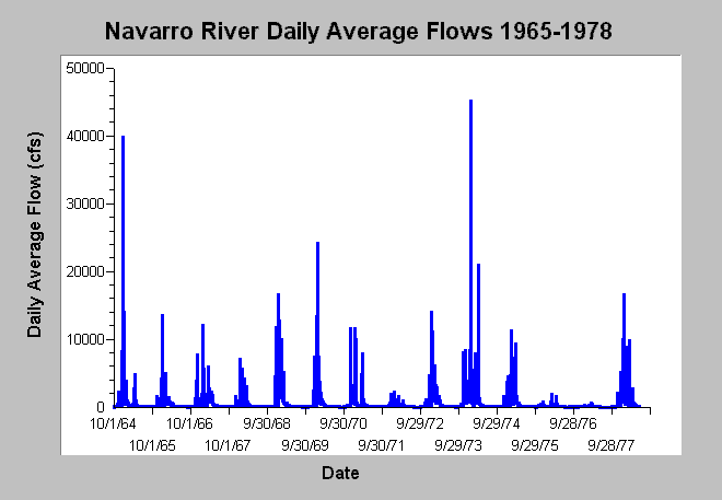
| Caption: This chart displays daily average flows (cfs) for the Navarro River near Navarro, CA (USGS gage # 11468000) between water years 1965 and 1978. While the peak associated with the infamous 1964 Flood was 39,800 cfs, flows in January 1974 were actually the highest of the entire gauge record (45,100 cfs). Dry water years include 1972, 1976, and 1977. Data are from the US Geological Survey. See Info Links for more information. | |
 |
To learn more about this topic click Info Links .
To view additional information (data source, aquisition date etc.) about this page, click Metadata .
To view the table with the chart's data, click Chart Table web page.
To download the table with the chart's data, click flow_navarro_usgs11468000_1965_1978.dbf (size 184,230 bytes) .
To view the table with the chart's source data, click Source Table web page.
To download the table with the chart's source data, click flow_navarro_usgs11468000_1951_2001.dbf (size 670,770 bytes)
| www.krisweb.com |