

|
Area/Topic | Bibliography | Background | Hypotheses | Home |
|
Map Page.
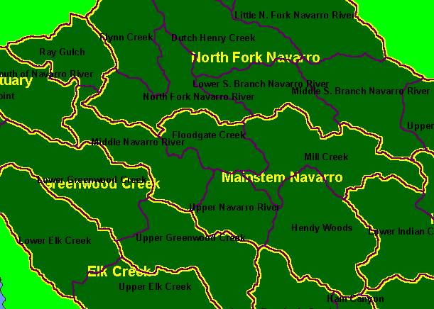
You selected the area Mainstem and the topic Map: 1A Calwater Planning Watersheds, Mainstem Navarro Sub-basin |
| This is a map of the Calwater Planning Watersheds (black labels) and KRIS Navarro project sub-basins (yellow labels) highlighting the Mainstem Navarro. This sub-basin extends from Hendy Woods, near where Anderson, Rancheria and Indian Creeks come together to form the Navarro River, and extends down to the estuary. Scale = 1:160,355 . | |||
|
|
||
To view metadata about a map layer, click on a link in the table below.
| Name of Layer in Map Legend | Metadata File Name |
|---|---|
| Calwater PWS (big labels) | calw22.shp.txt |
| Sub-basins (w/ labels) | subbasins.shp.txt |
| Project Frame | Unavailable |
| www.krisweb.com |