
|
Area/Topic | Bibliography | Background | Hypotheses | Home |
|
Map Page.
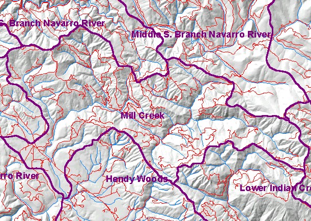
You selected the area Mainstem and the topic Sediment: Road Miles Inventoried in Mill Creek 1998-99 |
| This is a map of the roads in the Mill Creek watershed. The roads data may under-represent actual roads because roads layers are only updated periodically and may not have newly constructed roads. Data were contributed by the California Department of Forestry, which compiled them from a variety of sources, including 1:24,000 scale U.S. Geologic Survey maps, aerial photographs, and timber harvest plan maps. | |||
|
|
||
To view metadata about a map layer, click on a link in the table below.
| Name of Layer in Map Legend | Metadata File Name |
|---|---|
| Calwater PWS (w/ labels) | calw22.shp.txt |
| Project Frame | Unavailable |
| Roads (THP) | roads.shp.txt |
| Streams (1:24k scale)(no labels) | streams24.shp.txt |
| Bailey Ridge, DOQ | baileyridge.sid.txt |
| Navarro and Cold Springs, DOQ | navar_coldsp.sid.txt |
| Philo, DOQ | philo.sid.txt |
| Topo Map (1:24k scale) | Unavailable |
| Gray Hillshade of Elevtn (TIFF) | grayscale_xnv_light.tif.txt |
| www.krisweb.com |