
|
Area/Topic | Bibliography | Background | Hypotheses | Home |
|
Map Page.
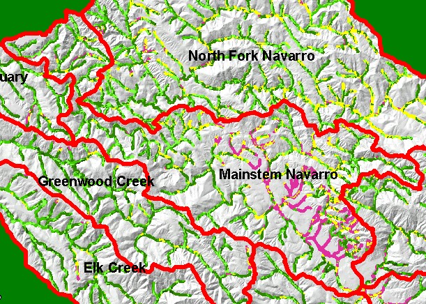
You selected the area Mainstem and the topic Map: 1E USFS Riparian Veg Size, Mainstem Navarro Sub-basin |
| This is a map of 1994 USFS Landsat vegetation size data within 90-meter riparian buffer zones in the Mainstem Navarro sub-basin. Displayed in the background is a grayscale hillshade of elevation. Note the Non-Forest signature for riparian areas of streams running through the valley. The vegetation classification is accurate at a one-hectare scale (approximately 11 pixels), so there may be some trees immediately next to the stream which do not show because of averaging. Data provided by the U.S. Forest Service Spatial Analysis Lab in Sacramento, CA. | |||
|
|
||
To view metadata about a map layer, click on a link in the table below.
| Name of Layer in Map Legend | Metadata File Name |
|---|---|
| Sub-basins (w/ labels) | subbasins.shp.txt |
| Project Frame | Unavailable |
| USFS Riparian Veg Size | vegsizebuf.tif.txt |
| USFS Vegetation Size | vegsize.tif.txt |
| Topo Map (1:24k scale) | Unavailable |
| Graycale Hillshade (TIFF) | grayscale_xnv_light.tif.txt |
| Project Background | Unavailable |
| www.krisweb.com |