
|
Area/Topic | Bibliography | Background | Hypotheses | Home |
|
Map Page.
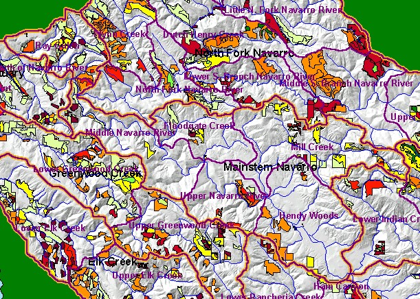
You selected the area Mainstem and the topic Map: 1G Timber Harvest, Mainstem Sub-basin 1990-2002 |
| This is a map of timber harvests permitted by the California Department of Forestry (CDF) in the Mainstem sub-basin between 1990 and 2002, displayed with Calwater Planning Watersheds, KRIS sub-basins, 1:100,000 scale streams, and a grayscale hillshade. Rays Gulch at the northern part of the Mainstem Navarro sub-basin has the most extensive timber harvest in this period. Data were provided by the California Department of Forestry, Santa Rosa. Scale = 1:160,721 . | |||
|
|
||
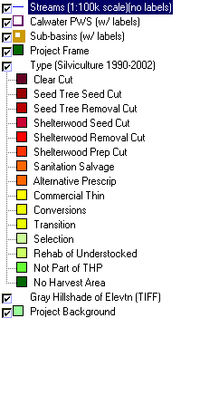
To view metadata about a map layer, click on a link in the table below.
| Name of Layer in Map Legend | Metadata File Name |
|---|---|
| Streams (1:100k scale)(no labels) | streams100.shp.txt |
| Calwater PWS (w/ labels) | calw22.shp.txt |
| Sub-basins (w/ labels) | subbasins.shp.txt |
| Project Frame | Unavailable |
| Change in Veget. (1994-98)(TIFF) | vegchg.tif.txt |
| Type (Silviculture 1990-2002) | thpcwrgns.shp.txt |
| Landslide Potential (Shalstab) [TIFF] | navarro_shalstab.tif.txt |
| Topo Map (1:24k scale) | Unavailable |
| Gray Hillshade of Elevtn (TIFF) | grayscale_xnv_light.tif.txt |
| Percent Slope of Elevation | slope1.tif.txt |
| Elevation (10 m resolution)(TIFF) | elev10.tif.txt |
| Project Background | Unavailable |
| www.krisweb.com |