| Area |
Mainstem |
| Topic |
Tour: Mill Creek photos 1995-2000 |
 Click on image to enlarge (23K). Click here to display a larger version (173K).
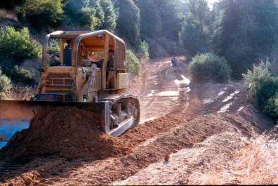
This photo shows Dean Titus building rolling dips on Big Meadow Road near Upper Mill Creek in his D7 CAT in fall, 1997. These dips are locally known as the "Dips of Misery." Danny Hagans of Pacific Watershed Associates, who supervised construction, is pictured in the background. Rolling dips are used to route sediment created by roads away from stream channels. See discussion of restoration techniques in the Navarro Watershed Restoration Plan (Entrix et al. (1998) in KRIS Bibliography. Photo provided by Dan Sicular.
 Click on image to enlarge (26K). Click here to display a larger version (223K).
This photo shows Dean Titus putting the finishing touches on a culvert replacement on Hungry Hollow Road in his D4 high track CAT. This culvert was replaced during summer, 2000, and passes beneath the back of the bulldozer. See discussion of restoration techniques in the Navarro Watershed Restoration Plan (Entrix et al. (1998) in KRIS Bibliography. Photo provided by Dan Sicular.
 Click on image to enlarge (30K). Click here to display a larger version (244K).
This photo shows Mill Creek near the old Nash Mill site during the winter, 1998. Although the riparian vegetation is recovering, the creek appears flat and featureless. According to a personal communication from restoration advocate Dan Sicular, "Mill Creek had a railroad built up the main channel and suffered from the effects of tractor logging during the boom after World War II, but the creek remains resilient." Photo provided by Dan Sicular.
 Click on image to enlarge (26K). Click here to display a larger version (197K).
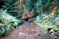
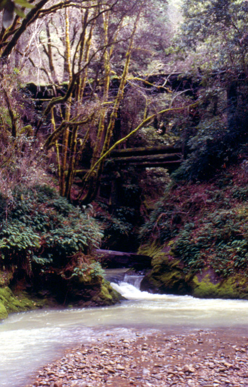
This photo shows an old trestle bridge on a logging road over Mill Creek during winter, 1998. The creek plunges into a deep pool in the foreground. Photo provided by Dan Sicular.
 Click on image to enlarge (31K). Click here to display a larger version (286K).
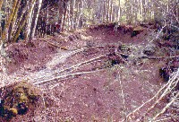
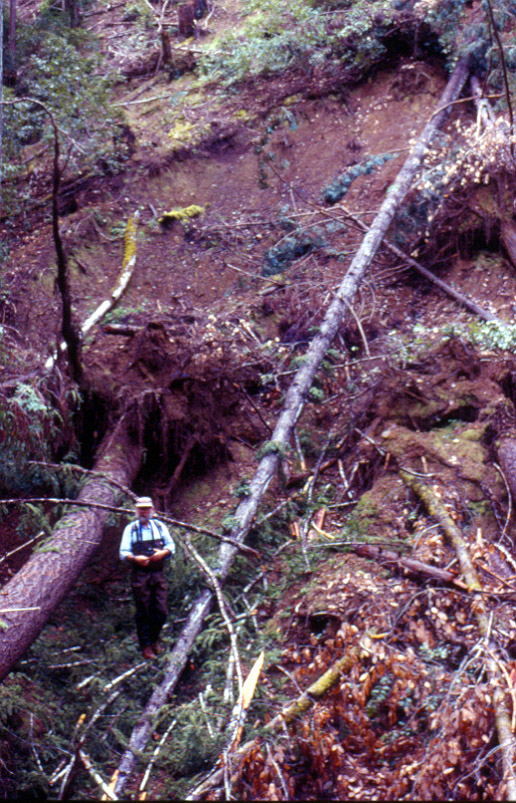
This photo shows a shallow landslide in an inner gorge region of Mill Creek in winter, 1995. This slide was located near the old trestle bridge. Shallow landslides are a common source of stream sediment input along inner gorge areas. The even age of the alder trees surrounding the slide suggest prior disturbance within the last twenty years. Photo provided by Dan Sicular.
 Click on image to enlarge (31K). Click here to display a larger version (228K).
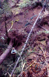
This photo shows a shallow landslide along an inner gorge region of Mill Creek in winter, 1995. Tom Taylor of Entrix is pictured at the lower left. Photo provided by Dan Sicular.
To learn more about this topic click Info Links
To view additional information (data source, aquisition date etc.) about this page, click Metadata

 Click on image to enlarge (23K). Click here to display a larger version (173K).
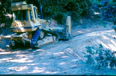 Click on image to enlarge (26K). Click here to display a larger version (223K).
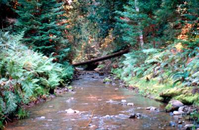 Click on image to enlarge (30K). Click here to display a larger version (244K).
 Click on image to enlarge (26K). Click here to display a larger version (197K).
 Click on image to enlarge (31K). Click here to display a larger version (286K).
 Click on image to enlarge (31K). Click here to display a larger version (228K).