| Area |
Mainstem |
| Topic |
Tour: Mainstem Navarro River air photos 2001 |
 Click on image to enlarge (76K). Click here to display a larger version (441K).
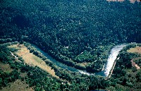
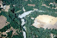
View of the mainstem Navarro River near the estuary showing brown patches of former agricultural flats. Notice the high water level in the channel as a result of the closed sand spit at the mouth of the river. See Cannata 2001 for information on habitat values of the estuary. Photo by Rixanne Wehren, August, 2001.
 Click on image to enlarge (71K). Click here to display a larger version (437K).
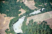
View of the mainstem Navarro River west of Dimmick State Park. Notice pale patches of sediment filling channel. Photo by Rixanne Wehren, August, 2001.
 Click on image to enlarge (69K). Click here to display a larger version (333K).
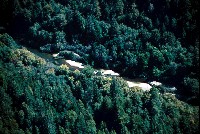
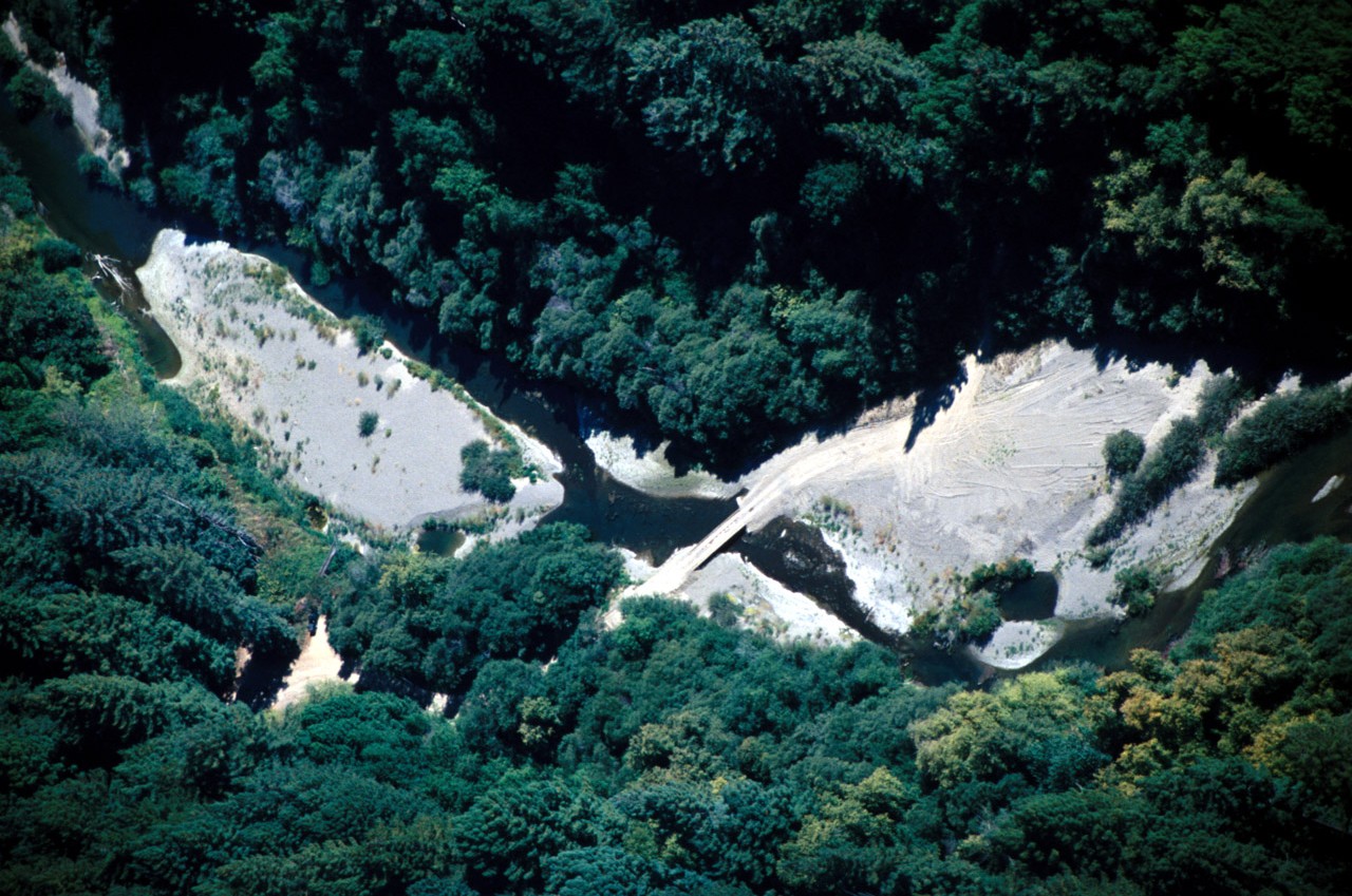
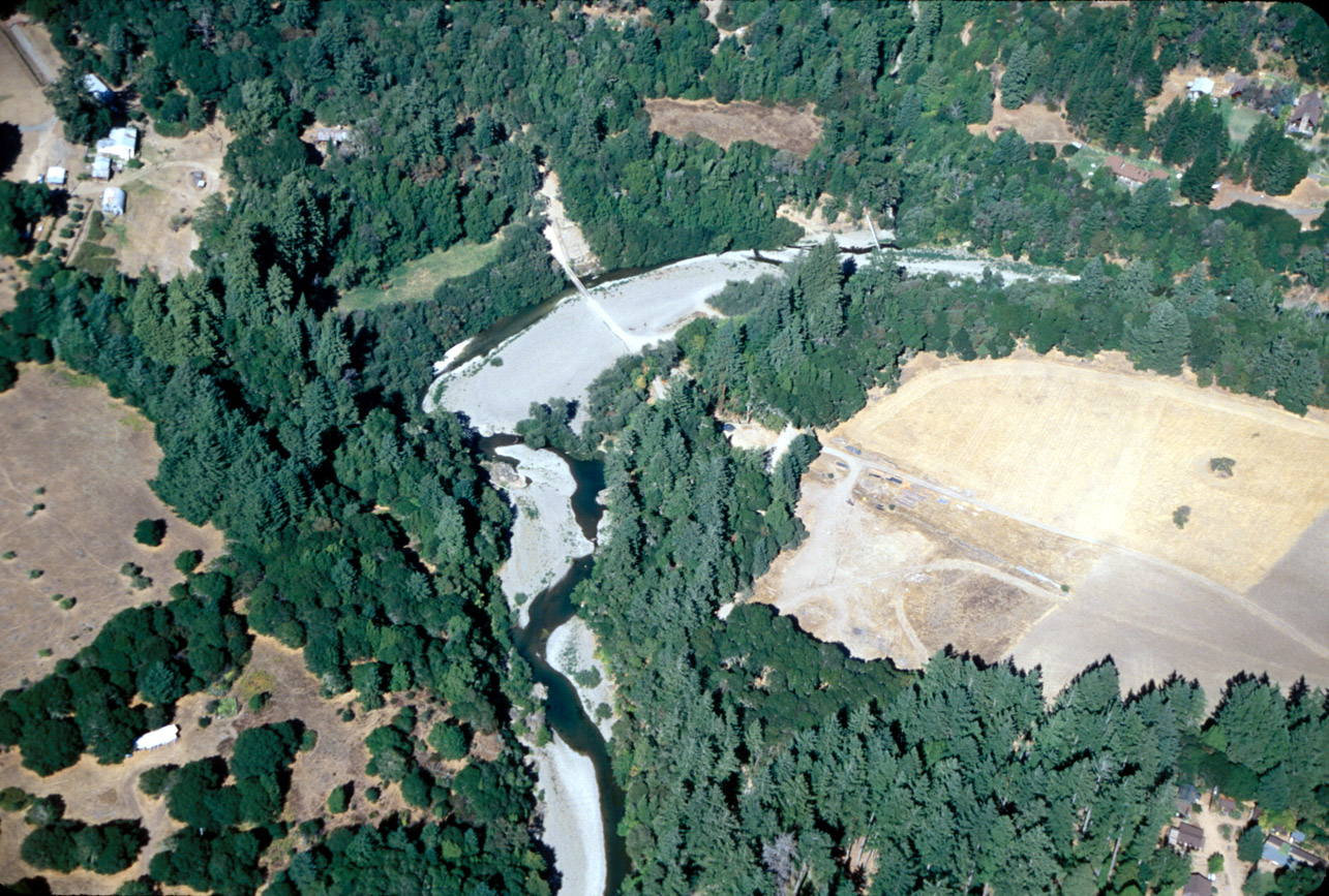
View of the mainstem Navarro River showing low water bridge crossing. Notice large pale patches of unvegetated sand bars filling channel. Disturbance on the bar downstream of the crossing suggests equipment has been used to grade the bar or extract gravel. Photo by Rixanne Wehren, August, 2001.
 Click on image to enlarge (68K). Click here to display a larger version (384K).
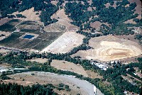
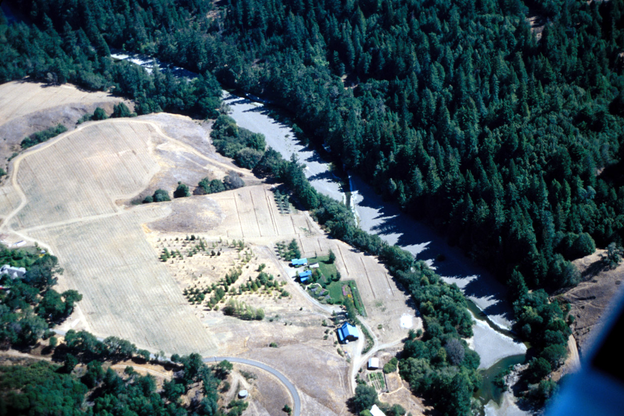
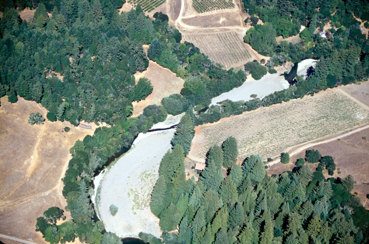
View of the mainstem Navarro River near Philo, CA, showing new vineyard development on the left side of the photo. The main channel of the Navarro River is visible flowing through the center of the photo. The river bar here shows major signs of aggradation, with the thread of wetted channel very small in comparison to the wide gravel bar. Photo by Rixanne Wehren, August, 2001.
 Click on image to enlarge (78K). Click here to display a larger version (435K).
View of the mainstem Navarro River near Jack's Valley Store. The main channel is visible in the foreground, with a thin, watered channel moving through the sediment choked channel. Notice the lack of vegetation on the near side of the channel bank. In the background is Duckhorn Vineyards pond development on the right. On the left and center are similar vineyard developments. Photo by Rixanne Wehren, August, 2001.
 Click on image to enlarge (69K). Click here to display a larger version (410K).
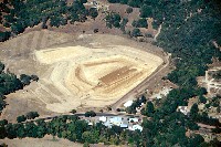
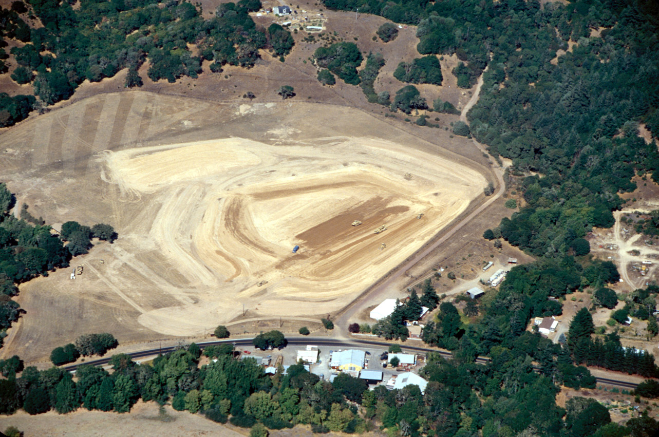
View of vineyard and pond development at Duckhorn Vineyards near the mainstem Navarro River at Jack's. The scale of the project is visible when comparing the size of the earth movers in the center of the photograph to the size of the pond. The Navarro River passes below the view of the photo. Photo by Rixanne Wehren, August, 2001.
 Click on image to enlarge (81K). Click here to display a larger version (465K).
View of the mainstem Navarro River showing the bridge to the Shenoa Resort near Philo, CA. Notice large pale patches of fine sediment filling channel devoid of vegetation. The aggradation causes the channel to be wide and the river to be shallow which facilitates stream warming. Photo by Rixanne Wehren, August, 2001.
 Click on image to enlarge (79K). Click here to display a larger version (476K).
View of the mainstem Navarro River showing vineyard development adjacent to the channel. Although riparian vegetation has been retained along the immediate wetted channel, there is no gallery forest or overstory. The river is almost losing surface flow here as a result of aggradation and possibly flow diversions. Photo by Rixanne Wehren, August, 2001.
To learn more about this topic click Info Links
To view additional information (data source, aquisition date etc.) about this page, click Metadata

 Click on image to enlarge (76K). Click here to display a larger version (441K).
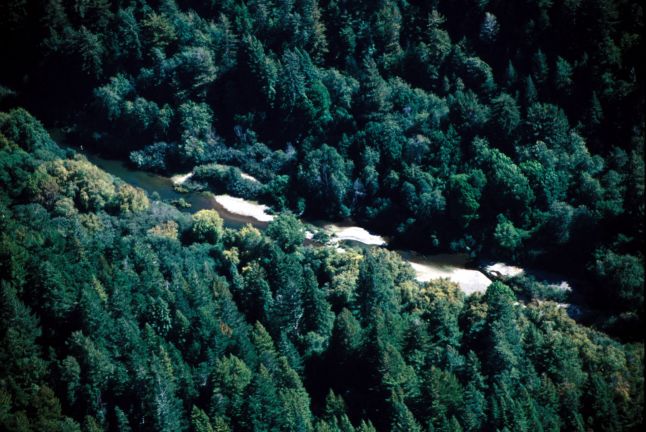 Click on image to enlarge (71K). Click here to display a larger version (437K).
 Click on image to enlarge (69K). Click here to display a larger version (333K).
 Click on image to enlarge (68K). Click here to display a larger version (384K).
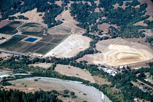 Click on image to enlarge (78K). Click here to display a larger version (435K).
 Click on image to enlarge (69K). Click here to display a larger version (410K).
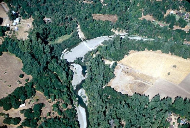 Click on image to enlarge (81K). Click here to display a larger version (465K).
 Click on image to enlarge (79K). Click here to display a larger version (476K).
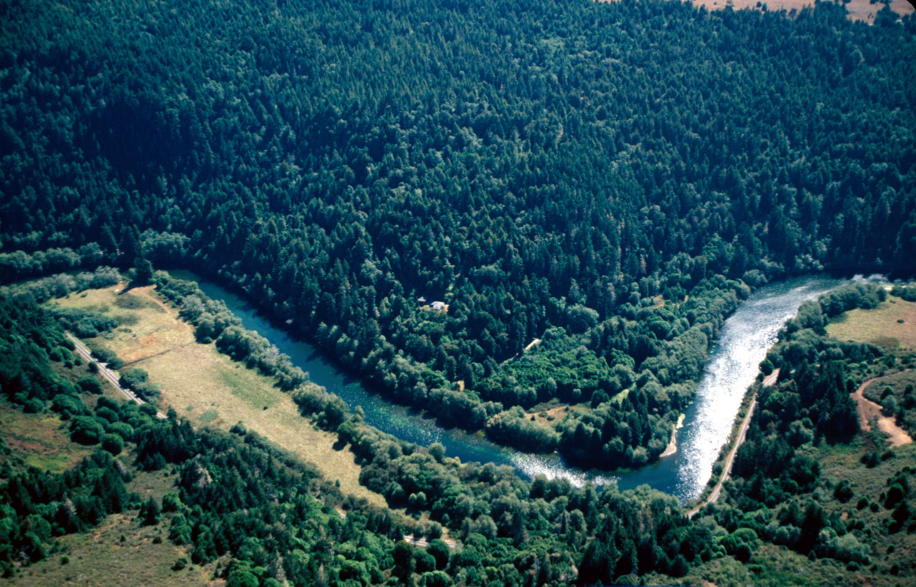