| Area |
Mainstem |
| Topic |
Tour: Mainstem Navarro River photos 2001 |
 Click on image to enlarge (103K). Click here to display a larger version (874K).
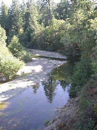
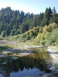
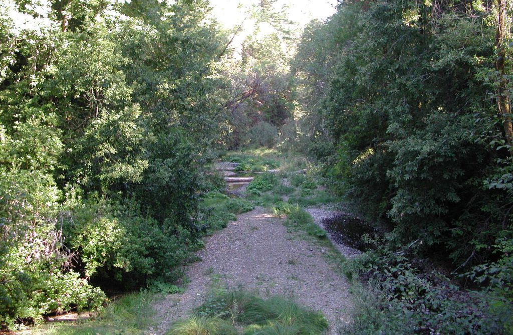
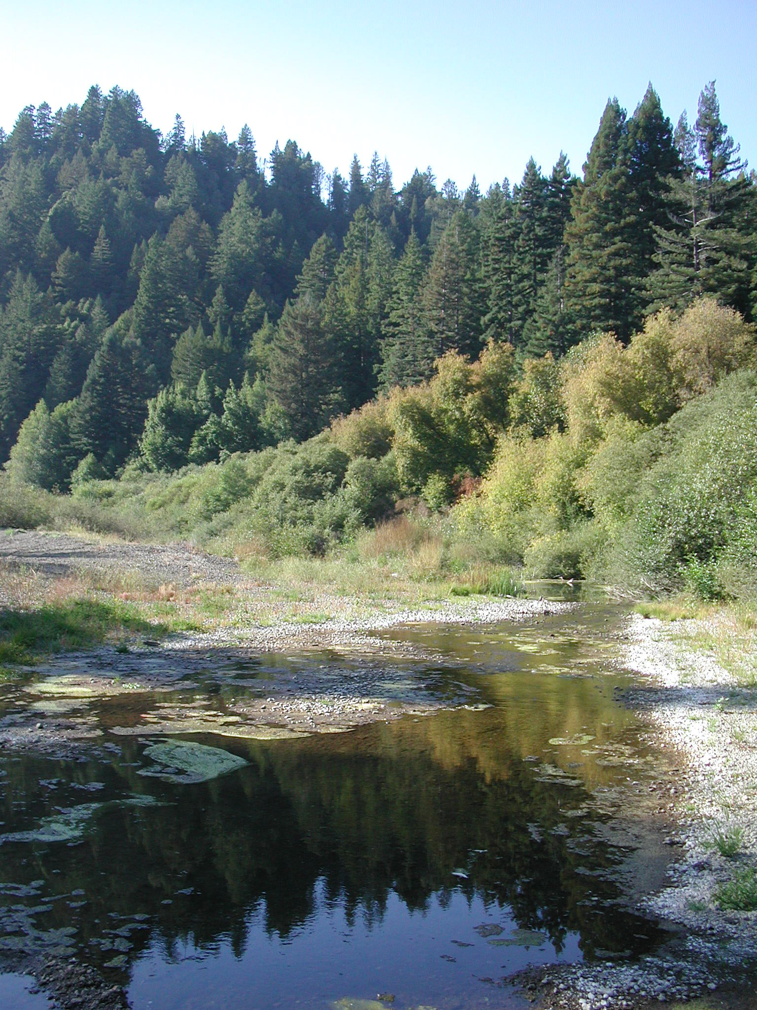
View looking upstream on the mainstem Navarro River near Greenwood Ridge Road Bridge at Hendy Woods State Park. The river is a stagnant pool here choked with algae at the time of the photo on September 21, 2001. Photo by Pat Higgins.
 Click on image to enlarge (63K). Click here to display a larger version (645K).
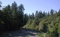
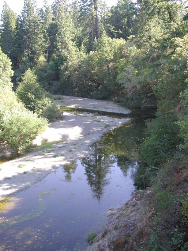
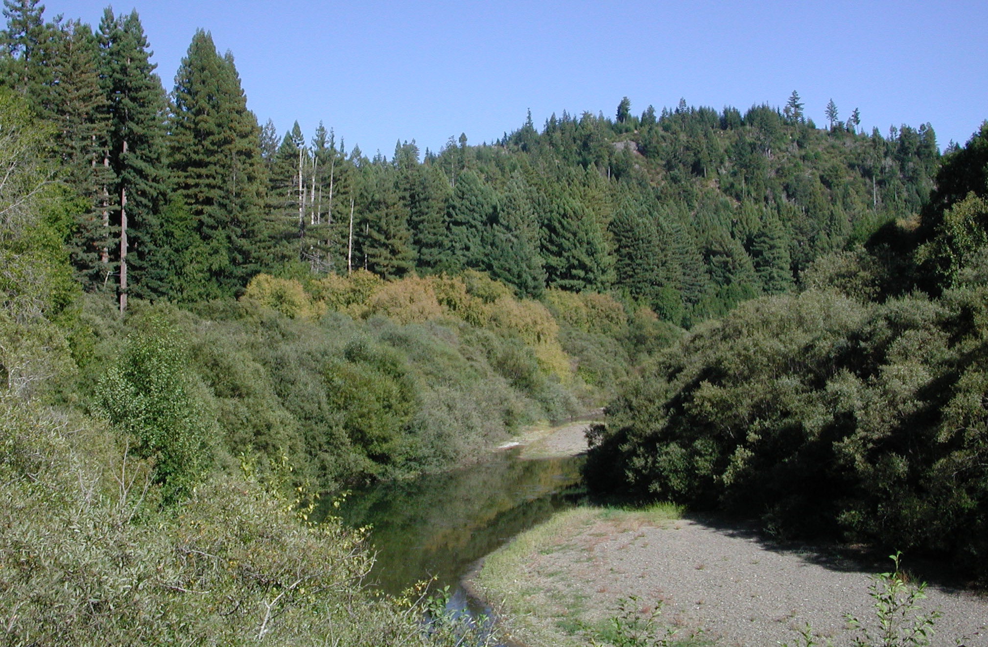
View looking downstream on mainstem Navarro River on Greenwood Ridge Road Bridge near Hendy Woods State Park. Although there is good cover from hardwood trees overhanging the channel on the right, the large gravel bar is a sign of major aggradation here. Algae can also be seen in the shallow portion of the channel in the distance. Photo by Pat Higgins, 9/21/01.
 Click on image to enlarge (47K). Click here to display a larger version (228K).
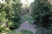
View looking upstream on mainstem Navarro River in Hendy Woods State Park. Streambed is nearly dry as a result of aggradation and flow depletion. The small particle size distribution on the gravel bar is consistent with high sediment supply. Photo by Pat Higgins, 9/21/01.
 Click on image to enlarge (85K). Click here to display a larger version (789K).
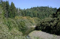
View looking upstream on the lower mainstem Navarro River off Highway 128 near the North Fork. Photo by Pat Higgins, 9/21/01.
 Click on image to enlarge (99K). Click here to display a larger version (847K).
View looking downstream on the lower mainstem Navarro River from a low water summer bridge. The shallow, warm water is causing an algae bloom as the Navarro almost loses surface flow at this point. The average daily flow on this date according to the USGS gauge was 1 cubic foot per second. Photo by Pat Higgins, 9/21/01.
 Click on image to enlarge (77K). Click here to display a larger version (454K).
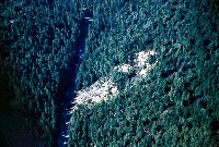
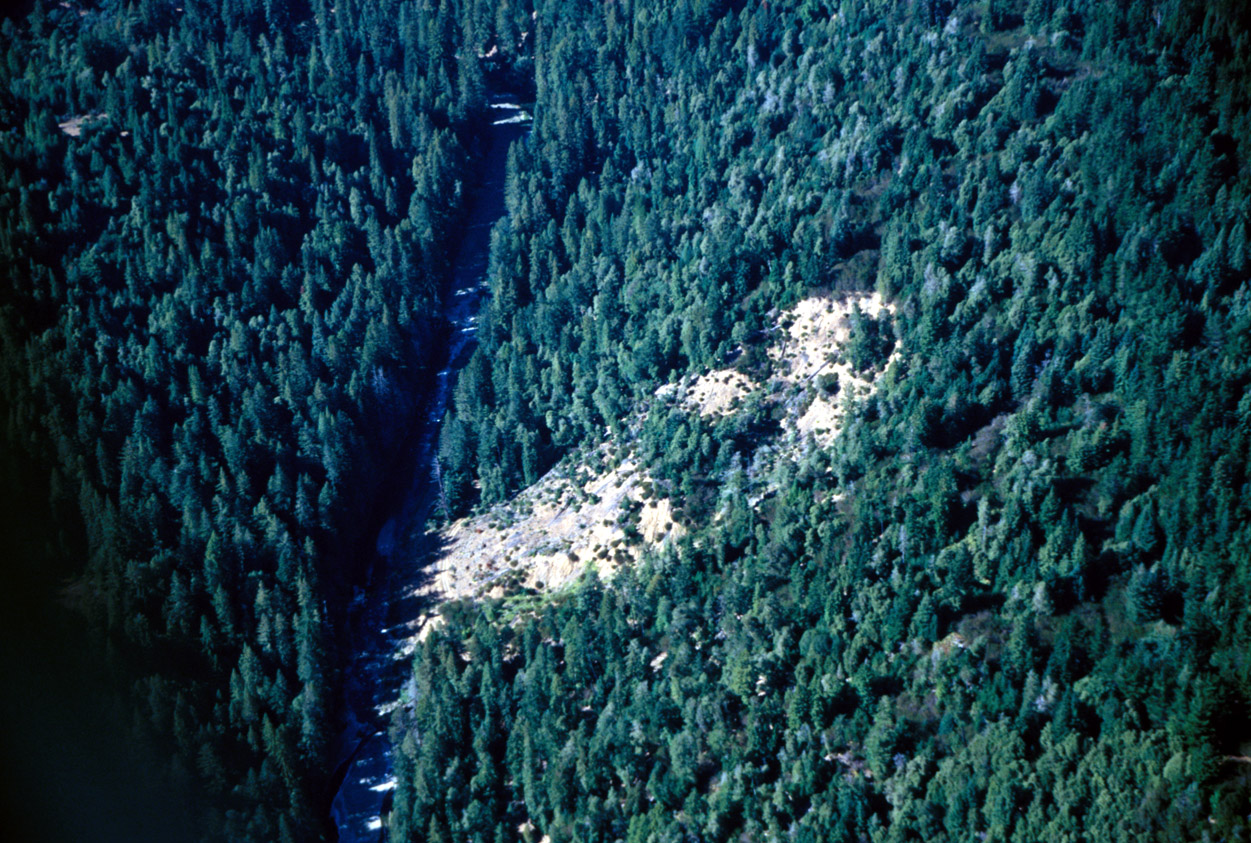
View of "Floodgate" landslide scar on the mainstem Navarro River just west of Floodgate Creek confluence. Photo by Rixanne Wehren, August, 2001. See the Topic: Stream Channel: Longitudinal Profile of Floodgate Landslide 1995-99
To learn more about this topic click Info Links
To view additional information (data source, aquisition date etc.) about this page, click Metadata

 Click on image to enlarge (103K). Click here to display a larger version (874K).
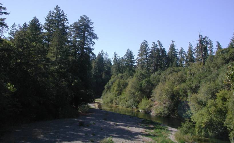 Click on image to enlarge (63K). Click here to display a larger version (645K).
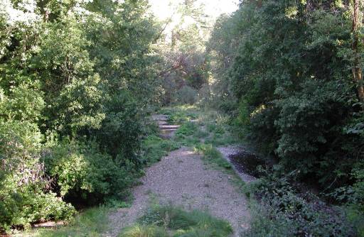 Click on image to enlarge (47K). Click here to display a larger version (228K).
 Click on image to enlarge (85K). Click here to display a larger version (789K).
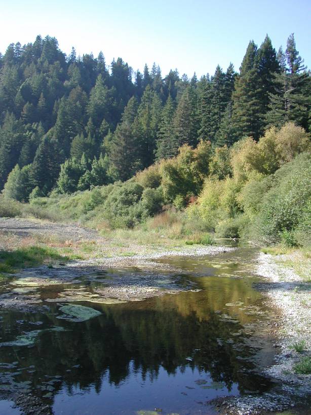 Click on image to enlarge (99K). Click here to display a larger version (847K).
 Click on image to enlarge (77K). Click here to display a larger version (454K).