
|
Area/Topic | Bibliography | Background | Hypotheses | Home |
|
Map Page.
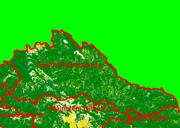
You selected the area North Fork and the topic Map: 1D EPA Landcover/Landuse, North Fork Sub-basin |
| This is a map of the 1992 Landsat derived Landcover/Landuse in the North Fork sub-basin, displayed with USGS 1:100,000 scale streams. Mixed conifer/hardwood forest signature in much of the basin denotes early seral stage conditions related to logging. Data provided by the U.S. Environmental Protection Agency. Scale = 1:185,573 . | |||
|
|
||
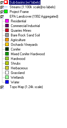
To view metadata about a map layer, click on a link in the table below.
| Name of Layer in Map Legend | Metadata File Name |
|---|---|
| Sub-basins (w/ labels) | subbasins.shp.txt |
| Streams (1:100k scale)(no labels) | streams100.shp.txt |
| Project Frame | Unavailable |
| EPA Landcover (1992 Aggregated) | lndcov2.tif.txt |
| EPA Landcover (1992) | lndcov.tif.txt |
| Topo Map (1:24k scale) | Unavailable |
| www.krisweb.com |